ملف:Zaporizhzhia region.png
حجم هذه المعاينة: 638 × 599 بكسل. البعد الآخر: 2٬210 × 2٬076 بكسل.
الملف الأصلي (2٬210 × 2٬076 بكسل حجم الملف: 781 كيلوبايت، نوع MIME: image/png)
وصف قصير
| ⧼wm-license-information-description⧽ |
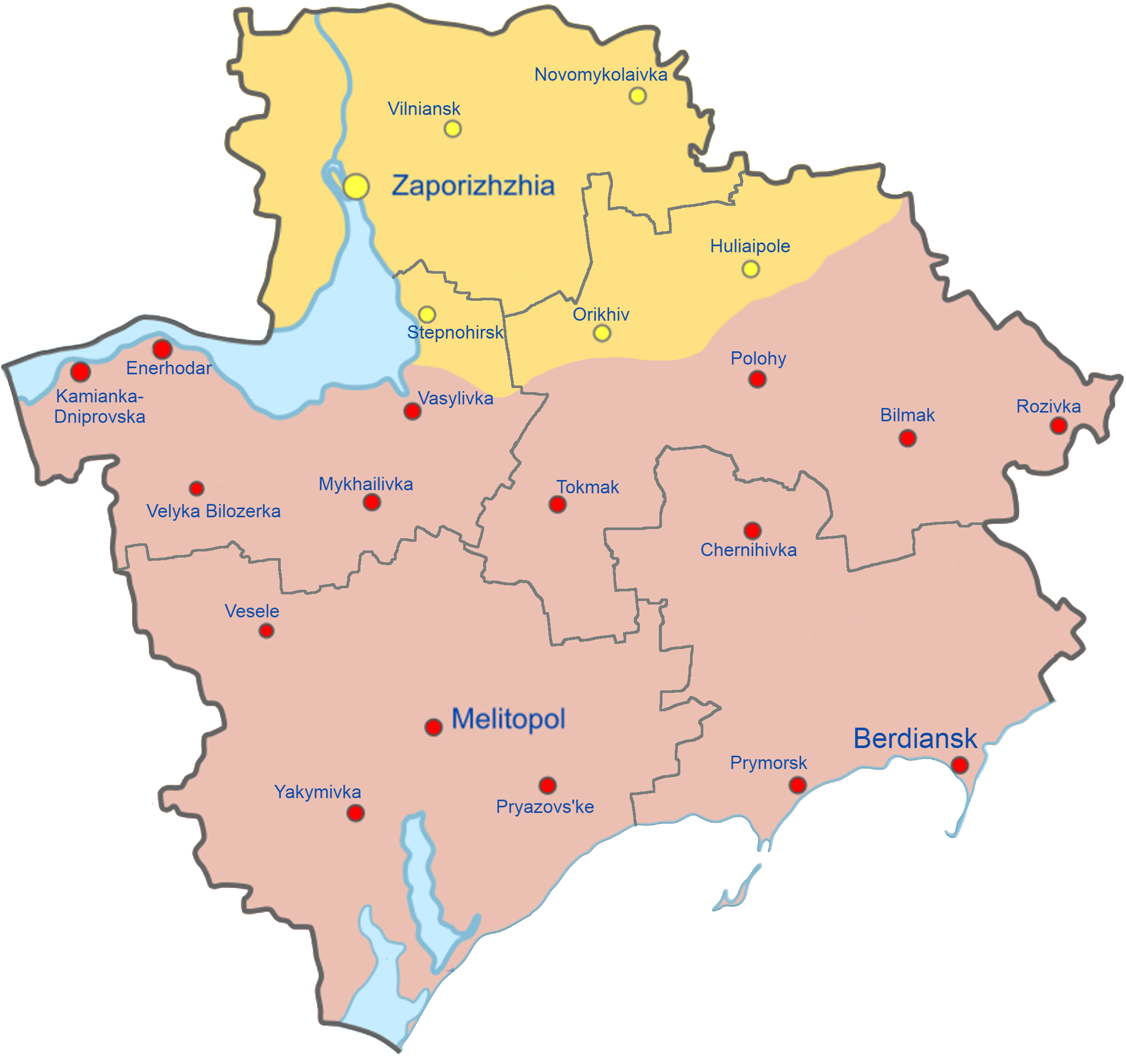
English: Map of Zaporizhzhia Oblast showing the rough zones of occupation during the southern offensive of the 2022 Russian invasion of Ukraine, as of August 2022.
Ukraine ( ) has maintained control over the north of the oblast, including the areas around the cities of Zaporizhzhia, Huliaipole and Orikhiv. The Russian occupation ( ) extends throughout the entire southern part of the oblast, including the major cities of Melitopol, Berdiansk and Enerhodar. |
| ⧼wm-license-information-date⧽ | 2022 |
| ⧼wm-license-information-source⧽ | ⧼Wm-license-own-work⧽ |
| ⧼wm-license-information-author⧽ | Qexypnos |
| ⧼wm-license-information-other-versions⧽ |
قالب:Ukraine Regional Occupation Mapsقالب:Derivative versions |
| أحداث هذه المقالة هي أحداث جارية. المعلومات المذكورة قد تتغير بسرعة مع تغير الحدث. |
ترخيص
|
تاريخ الملف
اضغط على زمن/تاريخ لرؤية الملف كما بدا في هذا الزمن.
| زمن/تاريخ | صورة مصغرة | الأبعاد | مستخدم | تعليق | |
|---|---|---|---|---|---|
| حالي | ★ مراجعة معتمدة 21:53، 1 ديسمبر 2023 | | 2٬210 × 2٬076 (781 كيلوبايت) | Pastakhov (نقاش | مساهمات) | Upload https://upload.wikimedia.org/wikipedia/commons/1/10/Zaporizhzhia_region.png |
لا يمكنك استبدال هذا الملف.
وصلات
لا يوجد صفحات تصل لهذه الصورة.