ملف:Youngstown Metro Counties.PNG
لا توجد دقة أعلى متوفرة.
Youngstown_Metro_Counties.PNG (293 × 173 بكسل حجم الملف: 11 كيلوبايت، نوع MIME: image/png)
وصف قصير
| ⧼wm-license-information-description⧽ |
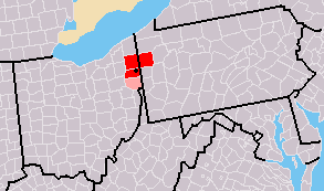
Map of Youngstown-Warren, OH-PA CSA
|
| ⧼wm-license-information-date⧽ | 7/31/2007 2:03 (UTC) |
| ⧼wm-license-information-source⧽ | Derivative work from File:Map of USA with county outlines.png, created by the author. |
| ⧼wm-license-information-author⧽ | Frank12 of English Wikipedia |
قالب:Original upload log
This image is a derivative work of the following images:
- File:Map_of_USA_with_county_outlines.png licensed with Cc-by-sa-3.0-migrated, GFDL
- 2008-01-23T04:41:16Z Speight 1513x983 (100713 Bytes) Fix San Francisco Bay and Puget Sound
- 2006-11-23T22:53:51Z Ibagli 1513x983 (169345 Bytes) more fixes
- 2006-11-23T22:53:05Z Ibagli 1513x983 (169416 Bytes) Reverted to earlier revision
- 2006-11-23T22:52:41Z Ibagli 1513x983 (184378 Bytes) more fixes
- 2006-11-23T02:16:28Z Ibagli 1513x983 (169416 Bytes) fix lake St. Clair
- 2005-08-28T20:57:13Z Huhsunqu 1513x983 (169340 Bytes) *{{es}} Mapa de los [[Estados Unidos de América]] mostrando los los límites de estados miembros y sus condados. Versión a colores de la adaptación hecha por [[en:User:Wapcaplet|Wapcaplet]] del mapa de dominio público del
ترخيص
تاريخ الملف
اضغط على زمن/تاريخ لرؤية الملف كما بدا في هذا الزمن.
| زمن/تاريخ | صورة مصغرة | الأبعاد | مستخدم | تعليق | |
|---|---|---|---|---|---|
| حالي | ★ مراجعة معتمدة 22:08، 19 أكتوبر 2023 | | 293 × 173 (11 كيلوبايت) | Pastakhov (نقاش | مساهمات) | Upload https://upload.wikimedia.org/wikipedia/commons/d/d7/Youngstown_Metro_Counties.PNG |
لا يمكنك استبدال هذا الملف.
وصلات
لا يوجد صفحات تصل لهذه الصورة.