ملف:York County Pennsylvania incorporated and unincorporated areas Wrightsville highlighted.svg

حجم معاينة PNG لذلك الملف ذي الامتداد SVG: 676 × 600 بكسل. البعد الآخر: 2٬308 × 2٬048 بكسل.
الملف الأصلي (ملف SVG، أبعاده 835 × 741 بكسل، حجم الملف: 4٫26 ميجابايت)
وصف قصير
| ⧼wm-license-information-description⧽ |
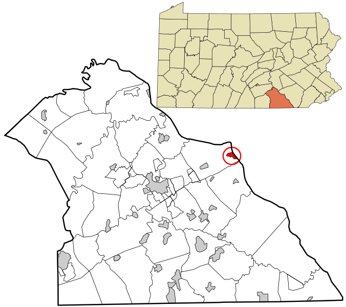
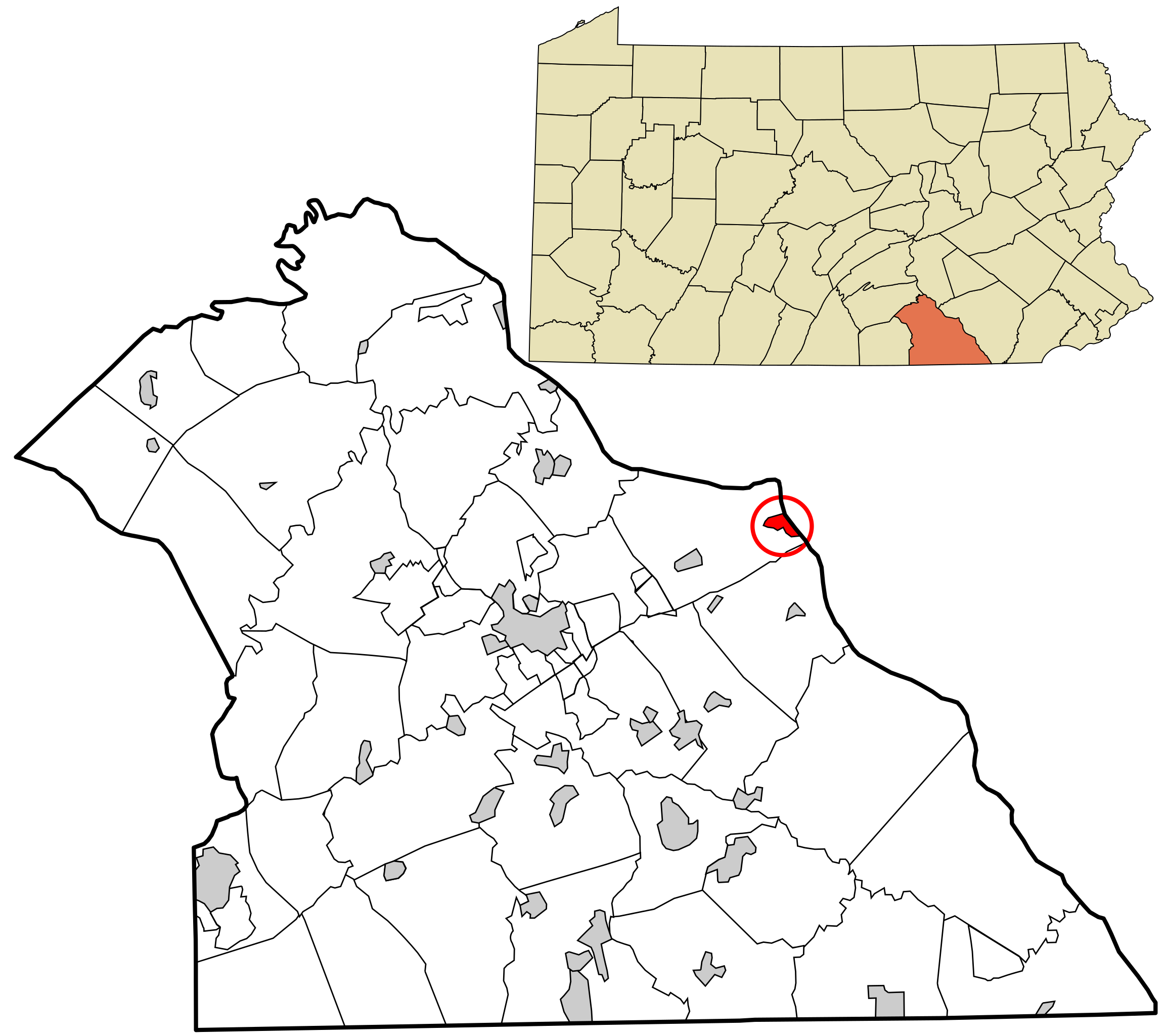
English: Map showing the location of this borough within York County, Pennsylvania. Data source: 2010 U.S. census
|
| ⧼wm-license-information-date⧽ | 2016 |
| ⧼wm-license-information-source⧽ | ⧼Wm-license-own-work⧽ |
| ⧼wm-license-information-author⧽ | Rcsprinter123 |
ترخيص
تاريخ الملف
اضغط على زمن/تاريخ لرؤية الملف كما بدا في هذا الزمن.
| زمن/تاريخ | صورة مصغرة | الأبعاد | مستخدم | تعليق | |
|---|---|---|---|---|---|
| حالي | ★ مراجعة معتمدة 07:42، 5 ديسمبر 2023 | | 835 × 741 (4٫26 ميجابايت) | Pastakhov (نقاش | مساهمات) | Upload https://upload.wikimedia.org/wikipedia/commons/a/a6/York_County_Pennsylvania_incorporated_and_unincorporated_areas_Wrightsville_highlighted.svg |
لا يمكنك استبدال هذا الملف.
وصلات
لا يوجد صفحات تصل لهذه الصورة.