ملف:Wyndham Place and St Mary's Church - geograph.org.uk - 542453.jpg
لا توجد دقة أعلى متوفرة.
Wyndham_Place_and_St_Mary's_Church_-_geograph.org.uk_-_542453.jpg (640 × 480 بكسل حجم الملف: 74 كيلوبايت، نوع MIME: image/jpeg)
وصف قصير
| ⧼wm-license-information-description⧽ |
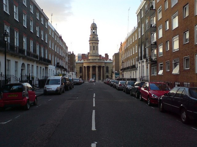
English: Wyndham Place and St Mary's Church. Compare with the picture from 1960 325347. Not much has changed about the buildings - the modern building on the right has filled the gap that was there in 1960. Another change isn't visible - I was standing on the traffic island that has been added at the end of the street, about where the white line ends in the old picture.
|
| ⧼wm-license-information-date⧽ | 2007 |
| ⧼wm-license-information-source⧽ | From geograph.org.uk |
| ⧼wm-license-information-author⧽ | RichTea |
51°31′07″N 0°09′41″W / 51.51868°N 0.1614°W قالب:Object location
_heading:0)
ترخيص
تاريخ الملف
اضغط على زمن/تاريخ لرؤية الملف كما بدا في هذا الزمن.
| زمن/تاريخ | صورة مصغرة | الأبعاد | مستخدم | تعليق | |
|---|---|---|---|---|---|
| حالي | ★ مراجعة معتمدة 09:37، 14 نوفمبر 2023 | | 640 × 480 (74 كيلوبايت) | Pastakhov (نقاش | مساهمات) | Upload https://upload.wikimedia.org/wikipedia/commons/a/a3/Wyndham_Place_and_St_Mary%27s_Church_-_geograph.org.uk_-_542453.jpg |
لا يمكنك استبدال هذا الملف.
وصلات
لا يوجد صفحات تصل لهذه الصورة.