ملف:West End Brook - geograph.org.uk - 1202363.jpg
لا توجد دقة أعلى متوفرة.
West_End_Brook_-_geograph.org.uk_-_1202363.jpg (640 × 428 بكسل حجم الملف: 244 كيلوبايت، نوع MIME: image/jpeg)
وصف قصير
| ⧼wm-license-information-description⧽ |
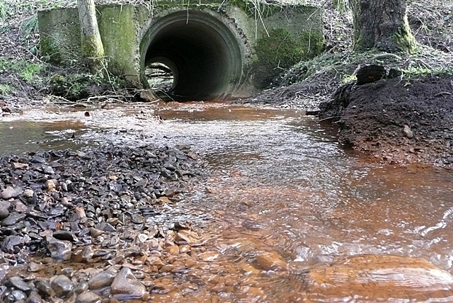
English: West End Brook The embryo brook has risen from Decoy Pond about 500 metres behind us, and goes through this culvert under the footpath to head gently towards Mortimer.
|
| ⧼wm-license-information-date⧽ | 2009 |
| ⧼wm-license-information-source⧽ | From geograph.org.uk |
| ⧼wm-license-information-author⧽ | Graham Horn |
| ⧼wm-license-cc-attribution⧽ (قالب:I18n/Credit line) |
Graham Horn / West End Brook / |
51°21′52″N 1°07′21″W / 51.36453°N 1.1225°W قالب:Object location
_heading:90)
ترخيص
تاريخ الملف
اضغط على زمن/تاريخ لرؤية الملف كما بدا في هذا الزمن.
| زمن/تاريخ | صورة مصغرة | الأبعاد | مستخدم | تعليق | |
|---|---|---|---|---|---|
| حالي | ★ مراجعة معتمدة 20:29، 15 ديسمبر 2023 | | 640 × 428 (244 كيلوبايت) | Pastakhov (نقاش | مساهمات) | Upload https://upload.wikimedia.org/wikipedia/commons/d/df/West_End_Brook_-_geograph.org.uk_-_1202363.jpg |
لا يمكنك استبدال هذا الملف.
وصلات
لا يوجد صفحات تصل لهذه الصورة.