ملف:View of Hat Yai City (I).jpg
حجم هذه المعاينة: 800 × 450 بكسل. البعدان الآخران: 2٬560 × 1٬440 بكسل | 6٬693 × 3٬765 بكسل.
الملف الأصلي (6٬693 × 3٬765 بكسل حجم الملف: 12٫29 ميجابايت، نوع MIME: image/jpeg)
وصف قصير
| ⧼wm-license-information-description⧽ |
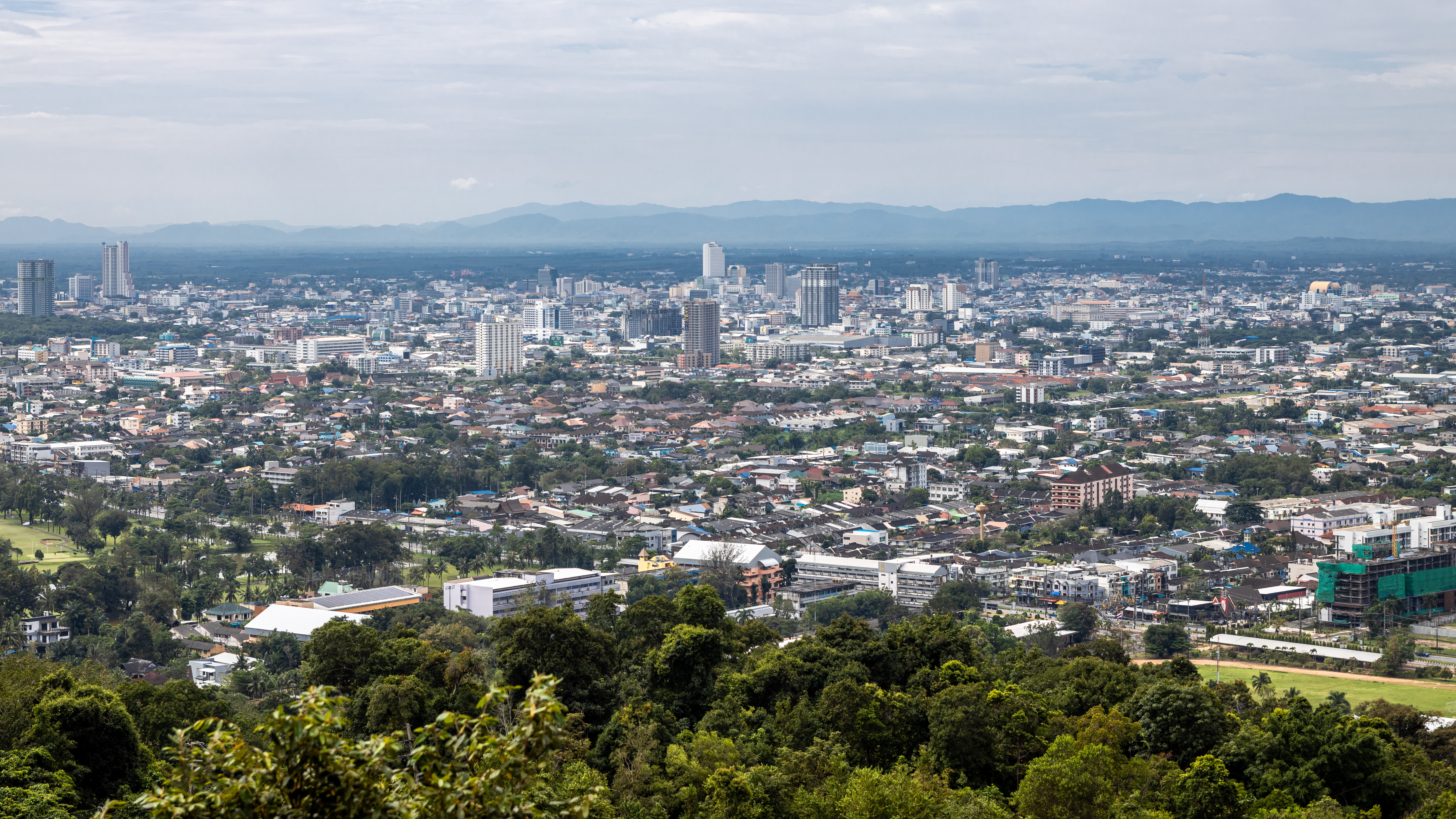
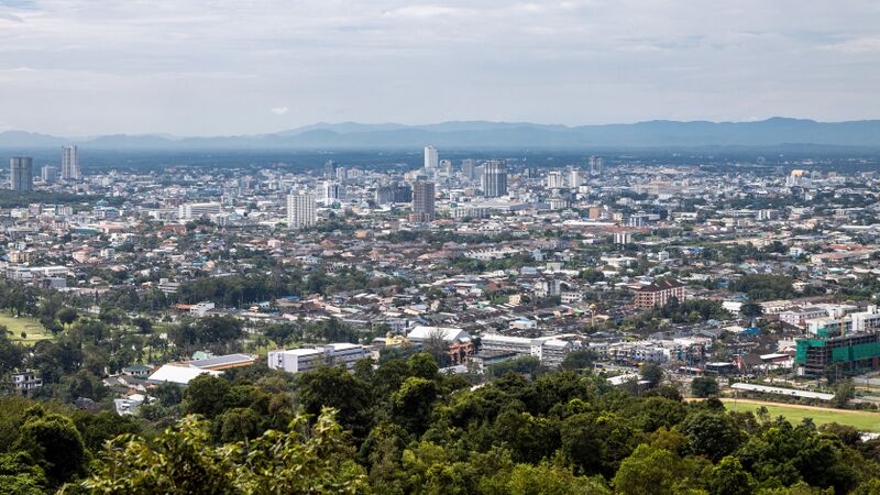
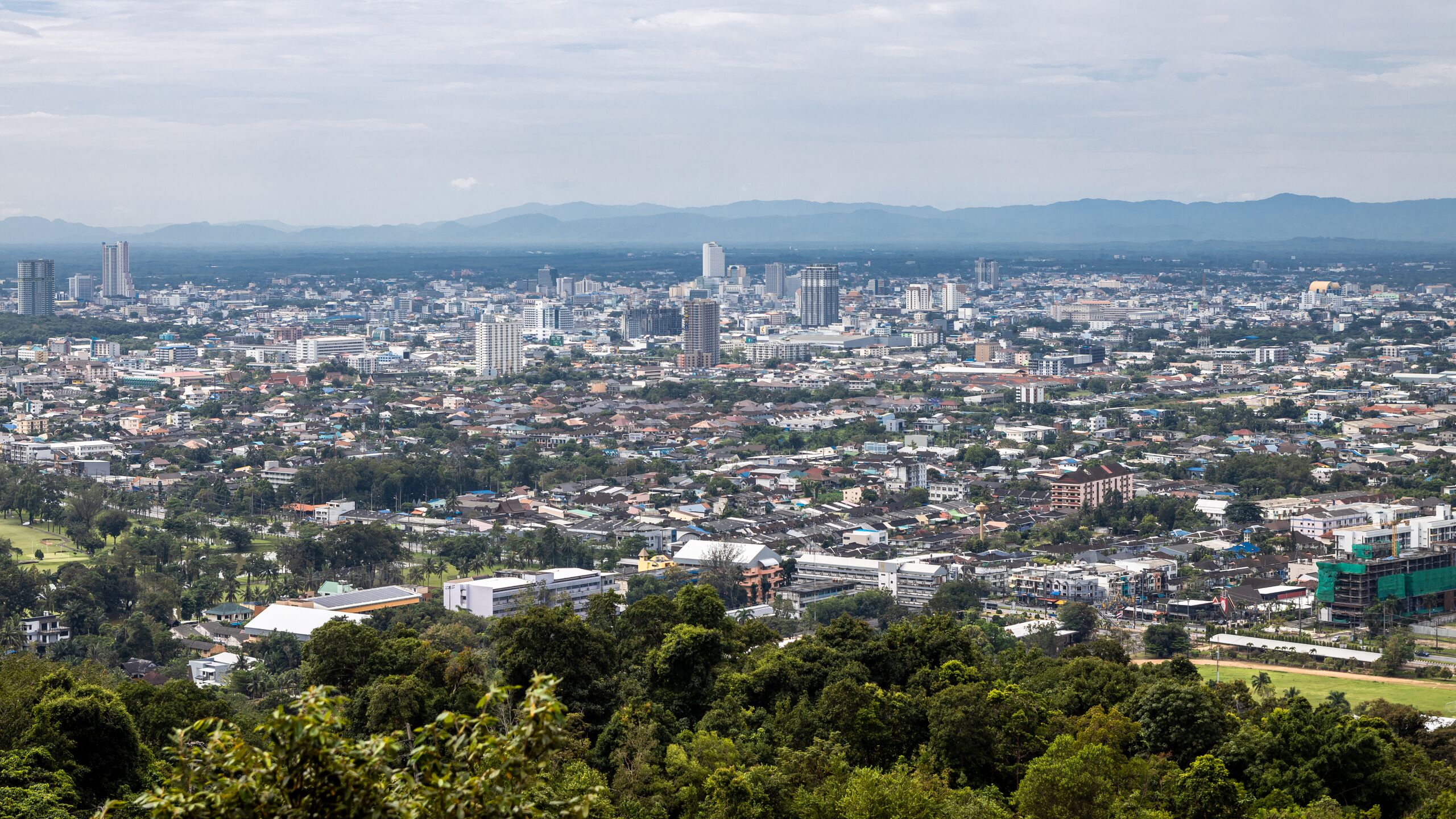
English: The skyline of Hat Yai City, Hat Yai District, Songkhla province, southern Thailand.
|
| ⧼wm-license-information-date⧽ | 2020, {{time}} – invalid date format 16 (help) |
| ⧼wm-license-information-source⧽ | ⧼Wm-license-own-work⧽ |
| ⧼wm-license-information-author⧽ | مستخدم:Supanut Arunoprayote/Template:Credits |
| ⧼wm-license-information-other-versions⧽ |
|
7°02′26″N 100°30′37″E / 7.04049°N 100.510392°E
.jpg¶ms=7.04049_N_100.510392_E_)
ترخيص
.jpg)
تاريخ الملف
اضغط على زمن/تاريخ لرؤية الملف كما بدا في هذا الزمن.
| زمن/تاريخ | صورة مصغرة | الأبعاد | مستخدم | تعليق | |
|---|---|---|---|---|---|
| حالي | ★ مراجعة معتمدة 10:09، 12 نوفمبر 2023 | | 6٬693 × 3٬765 (12٫29 ميجابايت) | Pastakhov (نقاش | مساهمات) | Upload https://upload.wikimedia.org/wikipedia/commons/f/f6/View_of_Hat_Yai_City_%28I%29.jpg |
لا يمكنك استبدال هذا الملف.
وصلات
لا يوجد صفحات تصل لهذه الصورة.
.jpg&oldid=3485886)