ملف:Unalakleet aerial 2010.jpg
حجم هذه المعاينة: 800 × 533 بكسل. البعدان الآخران: 2٬560 × 1٬707 بكسل | 5٬184 × 3٬456 بكسل.
الملف الأصلي (5٬184 × 3٬456 بكسل حجم الملف: 1٫4 ميجابايت، نوع MIME: image/jpeg)
وصف قصير
| ⧼wm-license-information-description⧽ |
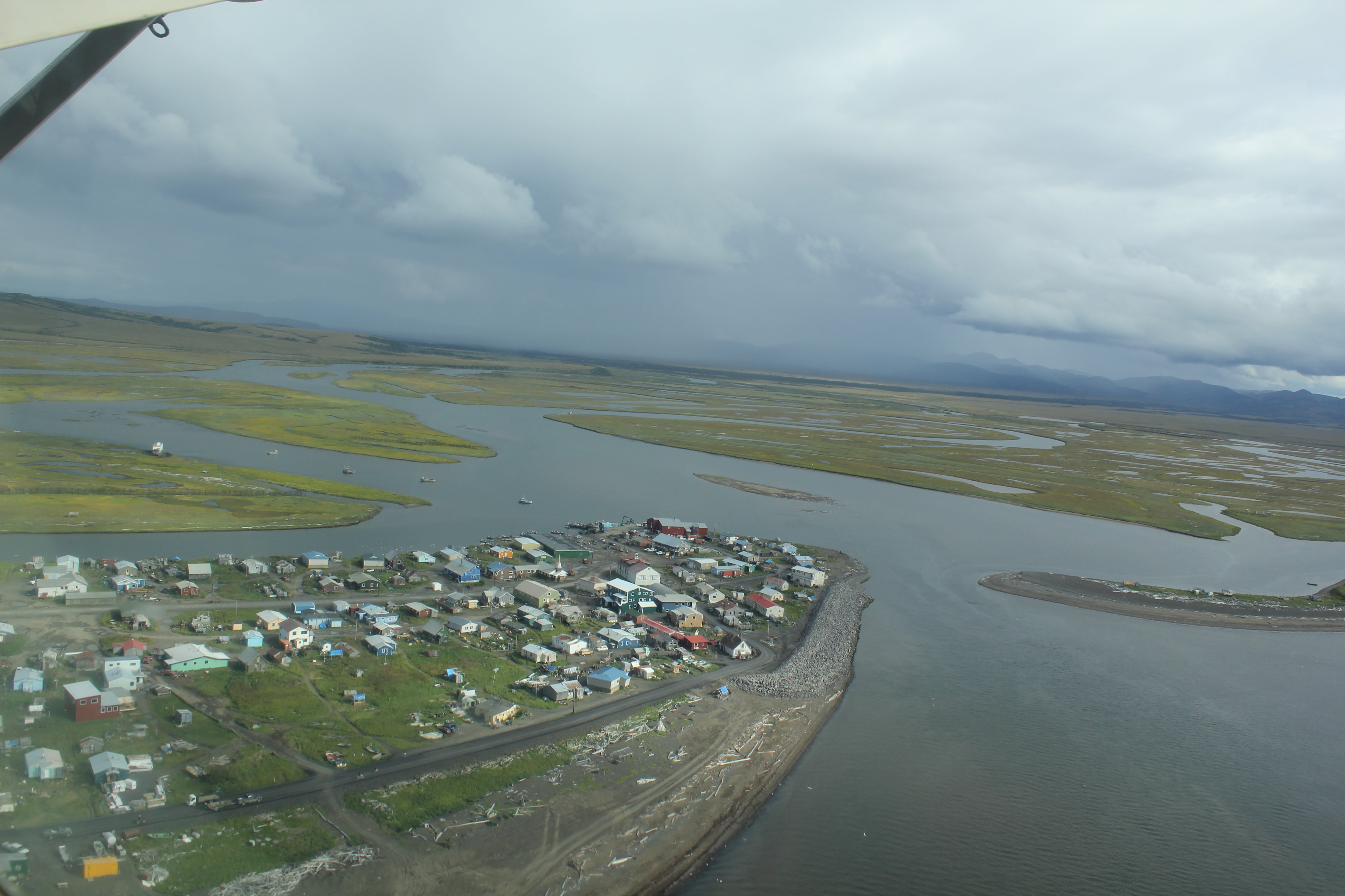
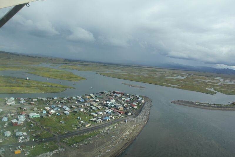
English: Native Village of Unalakleet. Unalakleet in Inupiat language is said to mean literally "Winds coming from the East." This is clearly visible in this image as the squall in the image came from the east and was soon raining on the Unalakleet Airport.
   Image ID: line5221, NOAA's America's Coastlines Collection
   Location: Alaska
Photo Date: 2010 August |
| ⧼wm-license-information-date⧽ | 2012 |
| ⧼wm-license-information-source⧽ | NOAA Photo Library [1] |
| ⧼wm-license-information-author⧽ | Dr. John Cloud, NOAA Central Library |
ترخيص

|
تاريخ الملف
اضغط على زمن/تاريخ لرؤية الملف كما بدا في هذا الزمن.
| زمن/تاريخ | صورة مصغرة | الأبعاد | مستخدم | تعليق | |
|---|---|---|---|---|---|
| حالي | ★ مراجعة معتمدة 00:20، 13 أكتوبر 2023 | | 5٬184 × 3٬456 (1٫4 ميجابايت) | Pastakhov (نقاش | مساهمات) | Upload https://upload.wikimedia.org/wikipedia/commons/8/83/Unalakleet_aerial_2010.jpg |
لا يمكنك استبدال هذا الملف.
وصلات
لا يوجد صفحات تصل لهذه الصورة.