ملف:Top drop of the Trough - geograph.org.uk - 1192102.jpg
لا توجد دقة أعلى متوفرة.
Top_drop_of_the_Trough_-_geograph.org.uk_-_1192102.jpg (640 × 480 بكسل حجم الملف: 71 كيلوبايت، نوع MIME: image/jpeg)
وصف قصير
| ⧼wm-license-information-description⧽ |
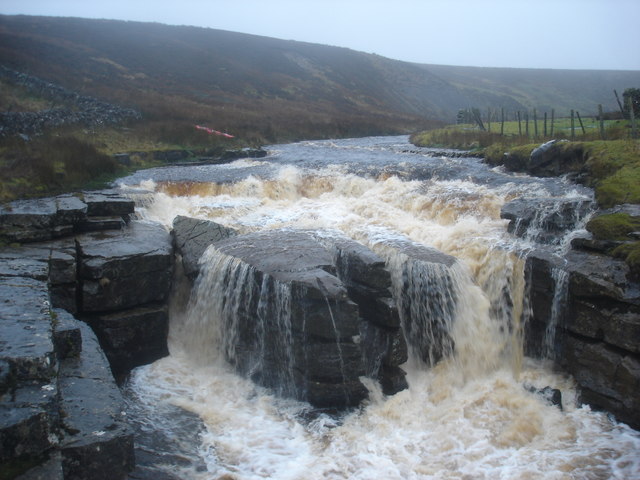
English: Top drop of the Trough. This is the top fall of the Trough, a 100m limestone gorge in Sleightholme Beck, seen in wet conditions high enough to paddle a kayak down the stream to this point. This was an exploratory paddle, and this drop was deemed unrunnable (the only previously recorded party to run this beck thought so too).
|
| ⧼wm-license-information-date⧽ | 2008 |
| ⧼wm-license-information-source⧽ | From geograph.org.uk |
| ⧼wm-license-information-author⧽ | Andy Waddington |
| ⧼wm-license-cc-attribution⧽ (قالب:I18n/Credit line) |
Andy Waddington / Top drop of the Trough / |
54°29′54″N 2°03′18″W / 54.49823°N 2.0550°W قالب:Object location
_heading:180)
ترخيص
تاريخ الملف
اضغط على زمن/تاريخ لرؤية الملف كما بدا في هذا الزمن.
| زمن/تاريخ | صورة مصغرة | الأبعاد | مستخدم | تعليق | |
|---|---|---|---|---|---|
| حالي | ★ مراجعة معتمدة 06:06، 15 يناير 2024 | | 640 × 480 (71 كيلوبايت) | Pastakhov (نقاش | مساهمات) | Upload https://upload.wikimedia.org/wikipedia/commons/7/74/Top_drop_of_the_Trough_-_geograph.org.uk_-_1192102.jpg |
لا يمكنك استبدال هذا الملف.
وصلات
لا يوجد صفحات تصل لهذه الصورة.