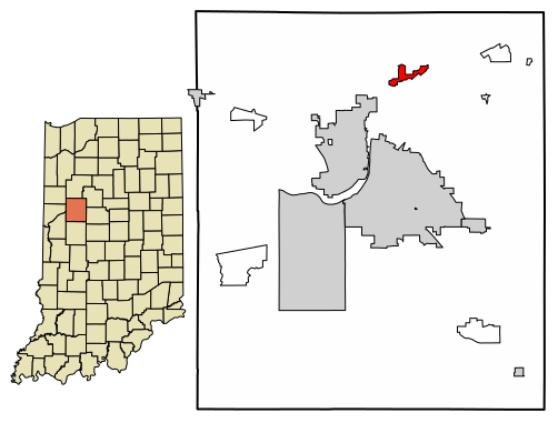
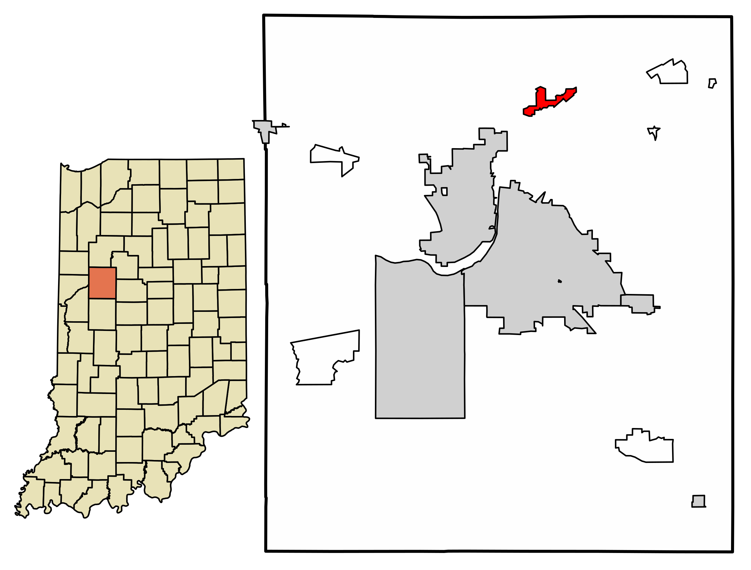
ملف:Tippecanoe County Indiana Incorporated and Unincorporated areas Battle Ground Highlighted 1803718.svg

حجم معاينة PNG لذلك الملف ذي الامتداد SVG: 502 × 381 بكسل. البعد الآخر: 2٬560 × 1٬943 بكسل.
الملف الأصلي (ملف SVG، أبعاده 502 × 381 بكسل، حجم الملف: 275 كيلوبايت)
وصف قصير
| ⧼wm-license-information-description⧽ |
Location of Battle Ground in Tippecanoe County, Indiana. FIPS code: 18-03718 Own work, based on concept by Arkyan, using Census Bureau Tiger GIS data and a custom fork of Kartography adapted for this purpose, available at |
| ⧼wm-license-information-date⧽ | |
| ⧼wm-license-information-source⧽ | قالب:Own work by original uploader |
| ⧼wm-license-information-author⧽ | DemocraticLuntz |
ترخيص
github
|
قالب:Original upload log
| زمن/تاريخ | الأبعاد | مستخدم | تعليق |
|---|---|---|---|
| 2017-07-28 15:31:39 | 502 × 381 | DemocraticLuntz |
تاريخ الملف
اضغط على زمن/تاريخ لرؤية الملف كما بدا في هذا الزمن.
| زمن/تاريخ | صورة مصغرة | الأبعاد | مستخدم | تعليق | |
|---|---|---|---|---|---|
| حالي | ★ مراجعة معتمدة 04:03، 21 أكتوبر 2023 | | 502 × 381 (275 كيلوبايت) | Pastakhov (نقاش | مساهمات) | Upload https://upload.wikimedia.org/wikipedia/commons/1/10/Tippecanoe_County_Indiana_Incorporated_and_Unincorporated_areas_Battle_Ground_Highlighted_1803718.svg |
لا يمكنك استبدال هذا الملف.
وصلات
لا يوجد صفحات تصل لهذه الصورة.