ملف:Thorney Island airfield from the air, May 1976 - geograph.org.uk - 345384.jpg
لا توجد دقة أعلى متوفرة.
Thorney_Island_airfield_from_the_air,_May_1976_-_geograph.org.uk_-_345384.jpg (640 × 560 بكسل حجم الملف: 42 كيلوبايت، نوع MIME: image/jpeg)
وصف قصير
| ⧼wm-license-information-description⧽ |
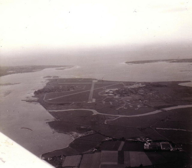
English: Thorney Island airfield from the air, May 1976 This is the former RAF station at Thorney Island pictured on 21st May 1976. It had closed not long before, on 31st March the same year. I think the army use it now.
(Probably not a proper geograph as it covers more than one square and was taken from quite a way off. I have also submitted aerial views of the Naval Dockyard, Whale Island and Hayling Island taken on the same flight.)
|
| ⧼wm-license-information-date⧽ | 1976 |
| ⧼wm-license-information-source⧽ | From geograph.org.uk |
| ⧼wm-license-information-author⧽ | Stephen Williams |
| ⧼wm-license-cc-attribution⧽ (قالب:I18n/Credit line) |
Stephen Williams / Thorney Island airfield from the air, May 1976 / |
50°49′58″N 0°55′01″W / 50.8328°N 0.917°W قالب:Object location
_heading:180)
ترخيص
تاريخ الملف
اضغط على زمن/تاريخ لرؤية الملف كما بدا في هذا الزمن.
| زمن/تاريخ | صورة مصغرة | الأبعاد | مستخدم | تعليق | |
|---|---|---|---|---|---|
| حالي | ★ مراجعة معتمدة 05:48، 5 أكتوبر 2023 | | 640 × 560 (42 كيلوبايت) | Pastakhov (نقاش | مساهمات) | Upload https://upload.wikimedia.org/wikipedia/commons/1/12/Thorney_Island_airfield_from_the_air%2C_May_1976_-_geograph.org.uk_-_345384.jpg |
لا يمكنك استبدال هذا الملف.
وصلات
لا يوجد صفحات تصل لهذه الصورة.