ملف:The old A5 (Watling Street) - geograph.org.uk - 373527.jpg
لا توجد دقة أعلى متوفرة.
The_old_A5_(Watling_Street)_-_geograph.org.uk_-_373527.jpg (640 × 480 بكسل حجم الملف: 175 كيلوبايت، نوع MIME: image/jpeg)
وصف قصير
| ⧼wm-license-information-description⧽ |
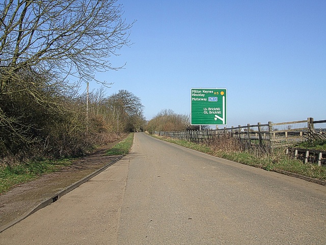
English: The old A5 (Watling Street) This is the old A5 that used to carry on through Little Brickhill village. The (comparatively) new A5 now sweeps round the village. The green sign is on this new road, showing how close it is to the old route at this point. I'm classifying this as "Road (disused)" as although still open to traffic, it is no longer the thoroughfare it used to be.
|
| ⧼wm-license-information-date⧽ | 2007 |
| ⧼wm-license-information-source⧽ | From geograph.org.uk |
| ⧼wm-license-information-author⧽ | Rob Farrow |
| ⧼wm-license-cc-attribution⧽ (قالب:I18n/Credit line) |
Rob Farrow / The old A5 (Watling Street) / |
51°58′30″N 0°39′50″W / 51.97497°N 0.6640°W قالب:Object location
_-_geograph.org.uk_-_373527.jpg¶ms=51.97497_N_0.664_W_source:geograph-osgb36(SP91863156)_heading:315)
ترخيص
تاريخ الملف
اضغط على زمن/تاريخ لرؤية الملف كما بدا في هذا الزمن.
| زمن/تاريخ | صورة مصغرة | الأبعاد | مستخدم | تعليق | |
|---|---|---|---|---|---|
| حالي | ★ مراجعة معتمدة 16:13، 12 نوفمبر 2023 | | 640 × 480 (175 كيلوبايت) | Pastakhov (نقاش | مساهمات) | Upload https://upload.wikimedia.org/wikipedia/commons/a/a6/The_old_A5_%28Watling_Street%29_-_geograph.org.uk_-_373527.jpg |
لا يمكنك استبدال هذا الملف.
وصلات
لا يوجد صفحات تصل لهذه الصورة.
_-_geograph.org.uk_-_373527.jpg&oldid=3491078)