ملف:Thames Street - geograph.org.uk - 793279.jpg
لا توجد دقة أعلى متوفرة.
Thames_Street_-_geograph.org.uk_-_793279.jpg (640 × 480 بكسل حجم الملف: 129 كيلوبايت، نوع MIME: image/jpeg)
وصف قصير
| ⧼wm-license-information-description⧽ |
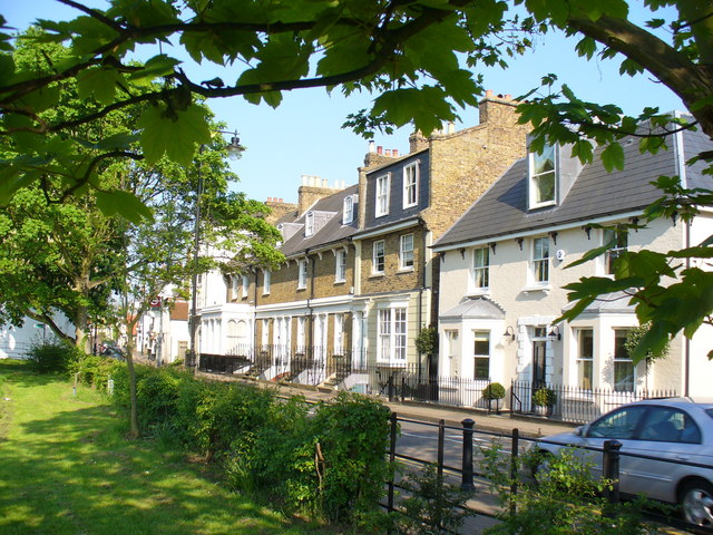
English: Thames Street Conservation Area expensive long riverside terrace dating from the 18th and 19th century in Sunbury. They face a grassy field named Orchard Meadow across the road (Thames Street); behind they have moorings with many steps and ornate patio gardens by the River Thames.
|
| ⧼wm-license-information-date⧽ | 2008 |
| ⧼wm-license-information-source⧽ | From geograph.org.uk |
| ⧼wm-license-information-author⧽ | Colin Smith |
| ⧼wm-license-cc-attribution⧽ (قالب:I18n/Credit line) |
Colin Smith / Thames Street / |
51°24′22″N 0°24′27″W / 51.40601°N 0.4075°W قالب:Object location
_heading:112)
ترخيص
تاريخ الملف
اضغط على زمن/تاريخ لرؤية الملف كما بدا في هذا الزمن.
| زمن/تاريخ | صورة مصغرة | الأبعاد | مستخدم | تعليق | |
|---|---|---|---|---|---|
| حالي | ★ مراجعة معتمدة 09:51، 15 يناير 2024 | | 640 × 480 (129 كيلوبايت) | Pastakhov (نقاش | مساهمات) | Upload https://upload.wikimedia.org/wikipedia/commons/9/9f/Thames_Street_-_geograph.org.uk_-_793279.jpg |
لا يمكنك استبدال هذا الملف.
وصلات
لا يوجد صفحات تصل لهذه الصورة.