ملف:Syrian Civil War map (November 24, 2023).svg

حجم معاينة PNG لذلك الملف ذي الامتداد SVG: 725 × 599 بكسل. البعد الآخر: 2٬478 × 2٬048 بكسل.
الملف الأصلي (ملف SVG، أبعاده 922 × 762 بكسل، حجم الملف: 3٫56 ميجابايت)
وصف قصير
| ⧼wm-license-information-description⧽ |
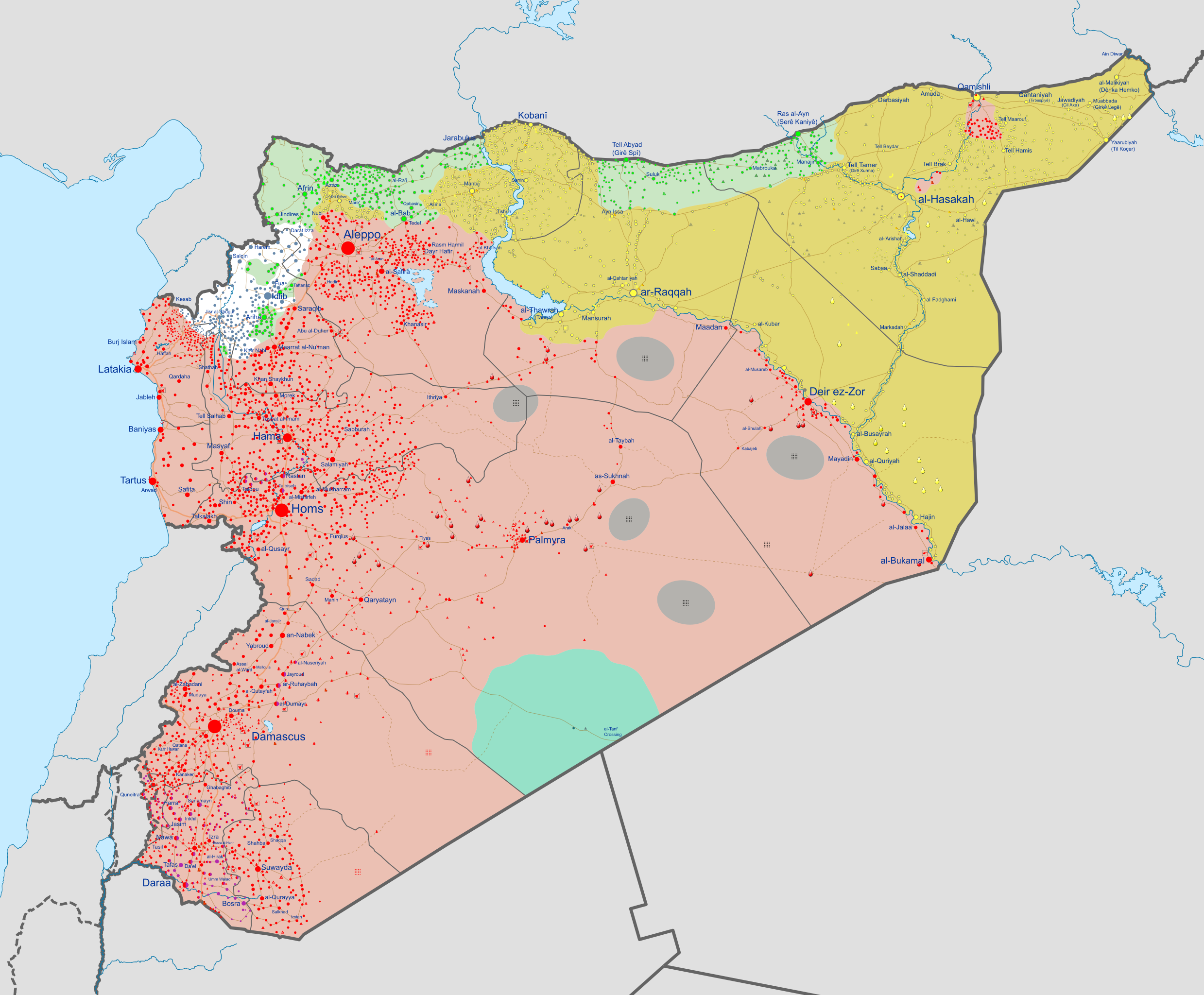
English: Detailed map of Syria showing the approximate frontlines during late-November 2023. Citing Al Jazeera.
ملف:Dot green 0d0.svg Controlled by the ملف:Syrian revolution flag.svg Syrian Interim Government (SNA and allies) and
ملف:Location dot teal.svg Controlled by Revolutionary Commando Army (MAT) and
|
| ⧼wm-license-information-date⧽ | 2023 |
| ⧼wm-license-information-source⧽ | Derivate of Syrian Civil War map (September 10 2021).svg by Rr016. قالب:Retouched picture |
| ⧼wm-license-information-author⧽ | Ecrusized |
| ⧼wm-license-information-other-versions⧽ |
If you want to see the history of the Syrian Civil War before 2020, look at Syrian Civil War map.svg |
.svg)
ترخيص
|
تاريخ الملف
اضغط على زمن/تاريخ لرؤية الملف كما بدا في هذا الزمن.
| زمن/تاريخ | صورة مصغرة | الأبعاد | مستخدم | تعليق | |
|---|---|---|---|---|---|
| حالي | ★ مراجعة معتمدة 20:43، 29 يوليو 2024 | | 922 × 762 (3٫56 ميجابايت) | Pastakhov (نقاش | مساهمات) | Upload https://upload.wikimedia.org/wikipedia/commons/9/92/Syrian_Civil_War_map_%28November_24%2C_2023%29.svg |
لا يمكنك استبدال هذا الملف.
وصلات
لا يوجد صفحات تصل لهذه الصورة.
.svg&oldid=4012980)