ملف:Stmauricerivermap.png
لا توجد دقة أعلى متوفرة.
Stmauricerivermap.png (500 × 500 بكسل حجم الملف: 132 كيلوبايت، نوع MIME: image/png)
| ⧼wm-license-information-description⧽ |
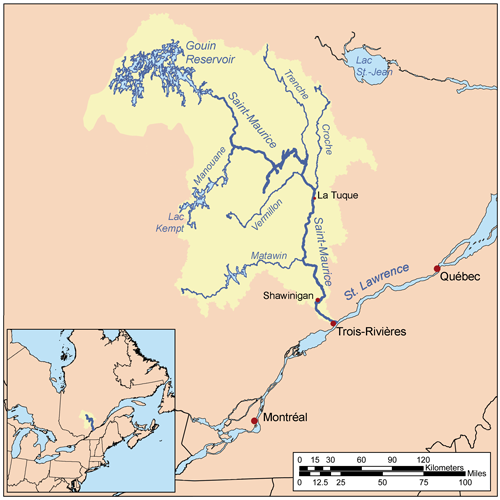
This is a map of the Saint-Maurice River drainage basin, created based on USGS and Digital Chart of the World data. [1] used as reference. |
| ⧼wm-license-information-date⧽ | 2007 |
| ⧼wm-license-information-source⧽ | ⧼Wm-license-own-work⧽ |
| ⧼wm-license-information-author⧽ | Kmusser |
تاريخ الملف
اضغط على زمن/تاريخ لرؤية الملف كما بدا في هذا الزمن.
| زمن/تاريخ | صورة مصغرة | الأبعاد | مستخدم | تعليق | |
|---|---|---|---|---|---|
| حالي | ★ مراجعة معتمدة 17:51، 9 أكتوبر 2023 | | 500 × 500 (132 كيلوبايت) | Pastakhov (نقاش | مساهمات) | Upload https://upload.wikimedia.org/wikipedia/commons/3/37/Stmauricerivermap.png |
لا يمكنك استبدال هذا الملف.
وصلات
لا يوجد صفحات تصل لهذه الصورة.