ملف:Stalisfield Church - guarded by bloodhounds - geograph.org.uk - 912153.jpg
حجم هذه المعاينة: 426 × 599 بكسل. البعد الآخر: 455 × 640 بكسل.
الملف الأصلي (455 × 640 بكسل حجم الملف: 64 كيلوبايت، نوع MIME: image/jpeg)
وصف قصير
| ⧼wm-license-information-description⧽ |
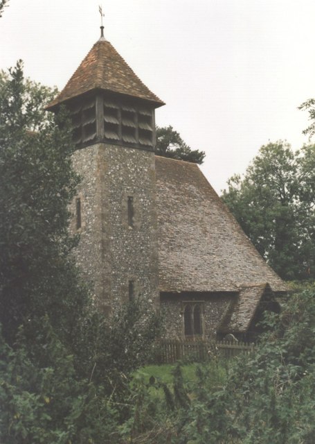
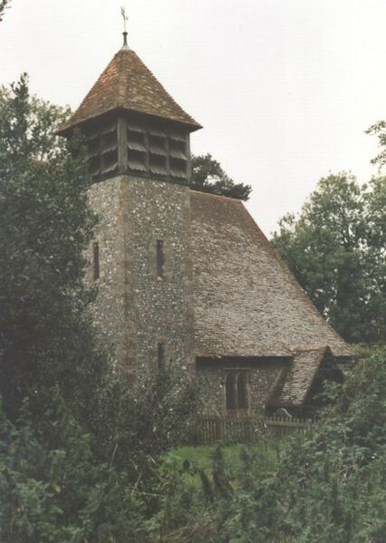
English: Stalisfield Church - guarded by bloodhounds The little church of Stalisfield is tucked away in the trees up on the North Downs alongside old farm building - used as kennels for a pack of bloodhounds when I visited. The church is distant from its main community, Stalisfield Green TQ9552, a mile away by footpath but further by road. The church registers go back to 1699. Indexed list of memorials and grave inscriptions as at 1920 http://www.kentarchaeology.org.uk/Research/Libr/MIs/MIsStalisfield/MIsStalisfield.htm . Village information http://www.faversham.org/pages/standard.aspx?i_PageID=1187 . See also 912175 and Gallery at: https://www.geograph.org.uk/gallery/trail_of_a_kentish_farming_family_9094 (background family story https://books.google.com/books?id=hrpS_YQ9FoAC&printsec=frontcover&dq=On+Kentish+Chalk )
|
| ⧼wm-license-information-date⧽ | 2004 |
| ⧼wm-license-information-source⧽ | From geograph.org.uk |
| ⧼wm-license-information-author⧽ | D Gore |
| ⧼wm-license-cc-attribution⧽ (قالب:I18n/Credit line) |
D Gore / Stalisfield Church – guarded by bloodhounds / |
51°14′12″N 0°49′04″E / 51.23679°N 0.8179°E قالب:Object location
_heading:315)
ترخيص
تاريخ الملف
اضغط على زمن/تاريخ لرؤية الملف كما بدا في هذا الزمن.
| زمن/تاريخ | صورة مصغرة | الأبعاد | مستخدم | تعليق | |
|---|---|---|---|---|---|
| حالي | ★ مراجعة معتمدة 04:42، 2 ديسمبر 2023 | | 455 × 640 (64 كيلوبايت) | Pastakhov (نقاش | مساهمات) | Upload https://upload.wikimedia.org/wikipedia/commons/4/4a/Stalisfield_Church_-_guarded_by_bloodhounds_-_geograph.org.uk_-_912153.jpg |
لا يمكنك استبدال هذا الملف.
وصلات
لا يوجد صفحات تصل لهذه الصورة.