ملف:Southern Entrance, Cuilfail Tunnel - geograph.org.uk - 292058.jpg
حجم هذه المعاينة: 449 × 600 بكسل. البعد الآخر: 479 × 640 بكسل.
الملف الأصلي (479 × 640 بكسل حجم الملف: 190 كيلوبايت، نوع MIME: image/jpeg)
وصف قصير
| ⧼wm-license-information-description⧽ |
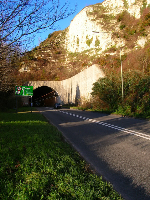
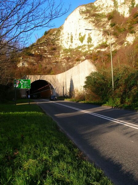
English: Southern Entrance, Cuilfail Tunnel Opened in 1980 to prevent the A26 clogging up the South Street area of Lewes. The southern part was located in an abandoned chalk quarry much of whose material was used to provide embankments for the Ouse.
|
| ⧼wm-license-information-date⧽ | 2006 |
| ⧼wm-license-information-source⧽ | From geograph.org.uk |
| ⧼wm-license-information-author⧽ | Simon Carey |
| ⧼wm-license-cc-attribution⧽ (قالب:I18n/Credit line) |
Simon Carey / Southern Entrance, Cuilfail Tunnel / |
50°52′21″N 0°01′23″E / 50.8724°N 0.023°E قالب:Object location
_heading:0)
ترخيص
تاريخ الملف
اضغط على زمن/تاريخ لرؤية الملف كما بدا في هذا الزمن.
| زمن/تاريخ | صورة مصغرة | الأبعاد | مستخدم | تعليق | |
|---|---|---|---|---|---|
| حالي | ★ مراجعة معتمدة 23:35، 21 أكتوبر 2023 | | 479 × 640 (190 كيلوبايت) | Pastakhov (نقاش | مساهمات) | Upload https://upload.wikimedia.org/wikipedia/commons/7/74/Southern_Entrance%2C_Cuilfail_Tunnel_-_geograph.org.uk_-_292058.jpg |
لا يمكنك استبدال هذا الملف.
وصلات
لا يوجد صفحات تصل لهذه الصورة.