ملف:Seir.png

حجم هذه المعاينة: 800 × 565 بكسل. البعدان الآخران: 2٬560 × 1٬809 بكسل | 3٬509 × 2٬480 بكسل.
الملف الأصلي (3٬509 × 2٬480 بكسل حجم الملف: 5٫67 ميجابايت، نوع MIME: image/png)
وصف قصير
| ⧼wm-license-information-description⧽ |
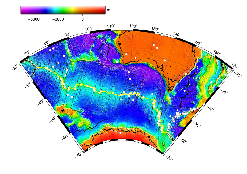
English: South East Indian Ridge (yellow line), with earthquake epicenters (white circles), fracture zones and seafloor topography. Made with GMT, lambert projection
|
| ⧼wm-license-information-date⧽ | 2012 |
| ⧼wm-license-information-source⧽ | ETOPO2, NOAA BOUNDARY/LINEATIO and QUAKES |
| ⧼wm-license-information-author⧽ | NOAA |
ترخيص

|
تاريخ الملف
اضغط على زمن/تاريخ لرؤية الملف كما بدا في هذا الزمن.
| زمن/تاريخ | صورة مصغرة | الأبعاد | مستخدم | تعليق | |
|---|---|---|---|---|---|
| حالي | ★ مراجعة معتمدة 21:29، 15 أكتوبر 2023 | | 3٬509 × 2٬480 (5٫67 ميجابايت) | Pastakhov (نقاش | مساهمات) | Upload https://upload.wikimedia.org/wikipedia/commons/0/0c/Seir.png |
لا يمكنك استبدال هذا الملف.
وصلات
لا يوجد صفحات تصل لهذه الصورة.