ملف:Scotland, Isle of Skye, Glamaig seen from Raasay.jpg
حجم هذه المعاينة: 800 × 531 بكسل. البعدان الآخران: 2٬560 × 1٬700 بكسل | 4٬288 × 2٬848 بكسل.
الملف الأصلي (4٬288 × 2٬848 بكسل حجم الملف: 3٫58 ميجابايت، نوع MIME: image/jpeg)
وصف قصير
| ⧼wm-license-information-description⧽ |
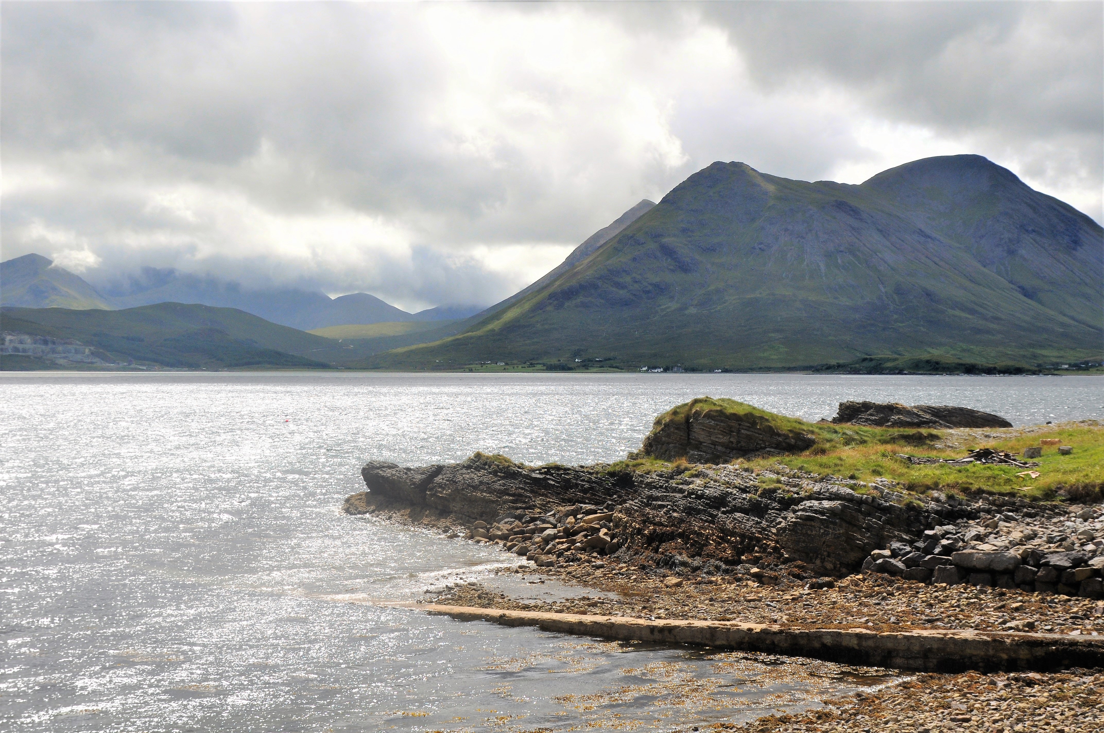
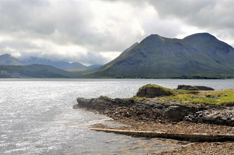
English: Glamaig, on the Isle of Skye (Scotland) with its two summits, seen from the harbour of Clachan on the Isle of Raasay. The summits, from right to left are: Sgùrr Mhairi (775m), An Coileach (673m) and (just behind An Coileach) Beinn Dearg Mhor (731m). They are all part of the Red Cuillin. At Glamaigs foot is the village of Sconser.
|
| ⧼wm-license-information-date⧽ | 2018 |
| ⧼wm-license-information-source⧽ | ⧼Wm-license-own-work⧽ |
| ⧼wm-license-information-author⧽ | Vincent van Zeijst |
Looking South from: 57°21′4.46″N 6°4′51.01″W / 57.3512389°N 6.0808361°W
ترخيص
|

تاريخ الملف
اضغط على زمن/تاريخ لرؤية الملف كما بدا في هذا الزمن.
| زمن/تاريخ | صورة مصغرة | الأبعاد | مستخدم | تعليق | |
|---|---|---|---|---|---|
| حالي | ★ مراجعة معتمدة 08:24، 18 نوفمبر 2023 | | 4٬288 × 2٬848 (3٫58 ميجابايت) | Pastakhov (نقاش | مساهمات) | Upload https://upload.wikimedia.org/wikipedia/commons/f/fa/Scotland%2C_Isle_of_Skye%2C_Glamaig_seen_from_Raasay.jpg |
لا يمكنك استبدال هذا الملف.
وصلات
لا يوجد صفحات تصل لهذه الصورة.