ملف:Saudia Arabia topographic map.jpg

حجم هذه المعاينة: 790 × 599 بكسل. البعد الآخر: 933 × 708 بكسل.
الملف الأصلي (933 × 708 بكسل حجم الملف: 280 كيلوبايت، نوع MIME: image/jpeg)
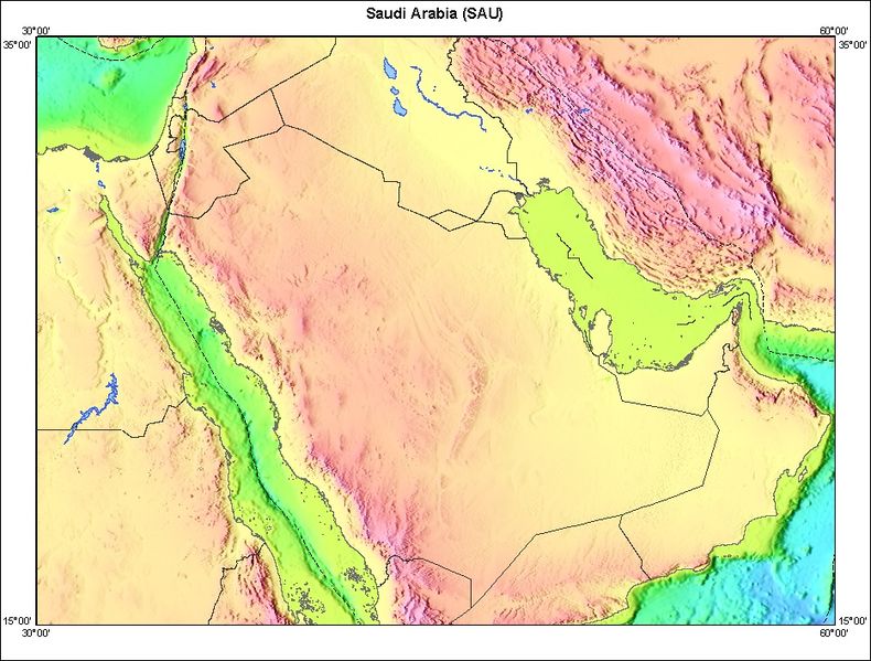
Topography of Saudia Arabia and surrounding countries.
http://walrus.wr.usgs.gov/infobank/gazette/html/regions/sau.html
This image is a work of a United States Geological Survey employee, taken or made during the course of the person's official duties. As a work of the United States Government, the image is in the public domain. For more information, see the USGS copyright policy.
تاريخ الملف
اضغط على زمن/تاريخ لرؤية الملف كما بدا في هذا الزمن.
| زمن/تاريخ | صورة مصغرة | الأبعاد | مستخدم | تعليق | |
|---|---|---|---|---|---|
| حالي | 14:52، 30 أكتوبر 2008 | | 933 × 708 (280 كيلوبايت) | اØمد الشري٠(نقاش | مساهمات) |
لا يمكنك استبدال هذا الملف.
وصلات
الصفحات التالية تحتوي على وصلة لهذه الصورة: