ملف:STAPP 030 San Fernando Marabella.jpg
حجم هذه المعاينة: 800 × 454 بكسل. البعدان الآخران: 2٬560 × 1٬452 بكسل | 3٬840 × 2٬178 بكسل.
الملف الأصلي (3٬840 × 2٬178 بكسل حجم الملف: 4٫06 ميجابايت، نوع MIME: image/jpeg)
وصف قصير
| ⧼wm-license-information-description⧽ |
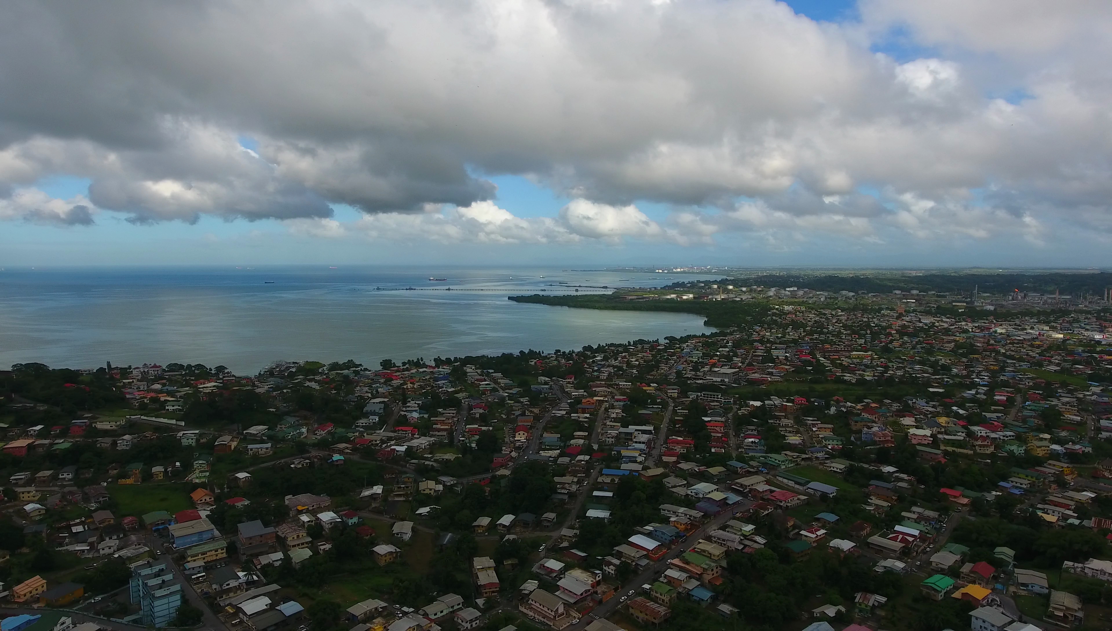
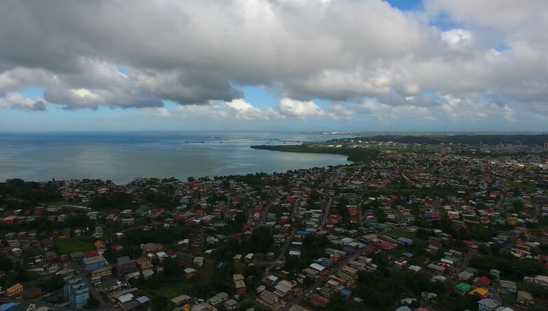
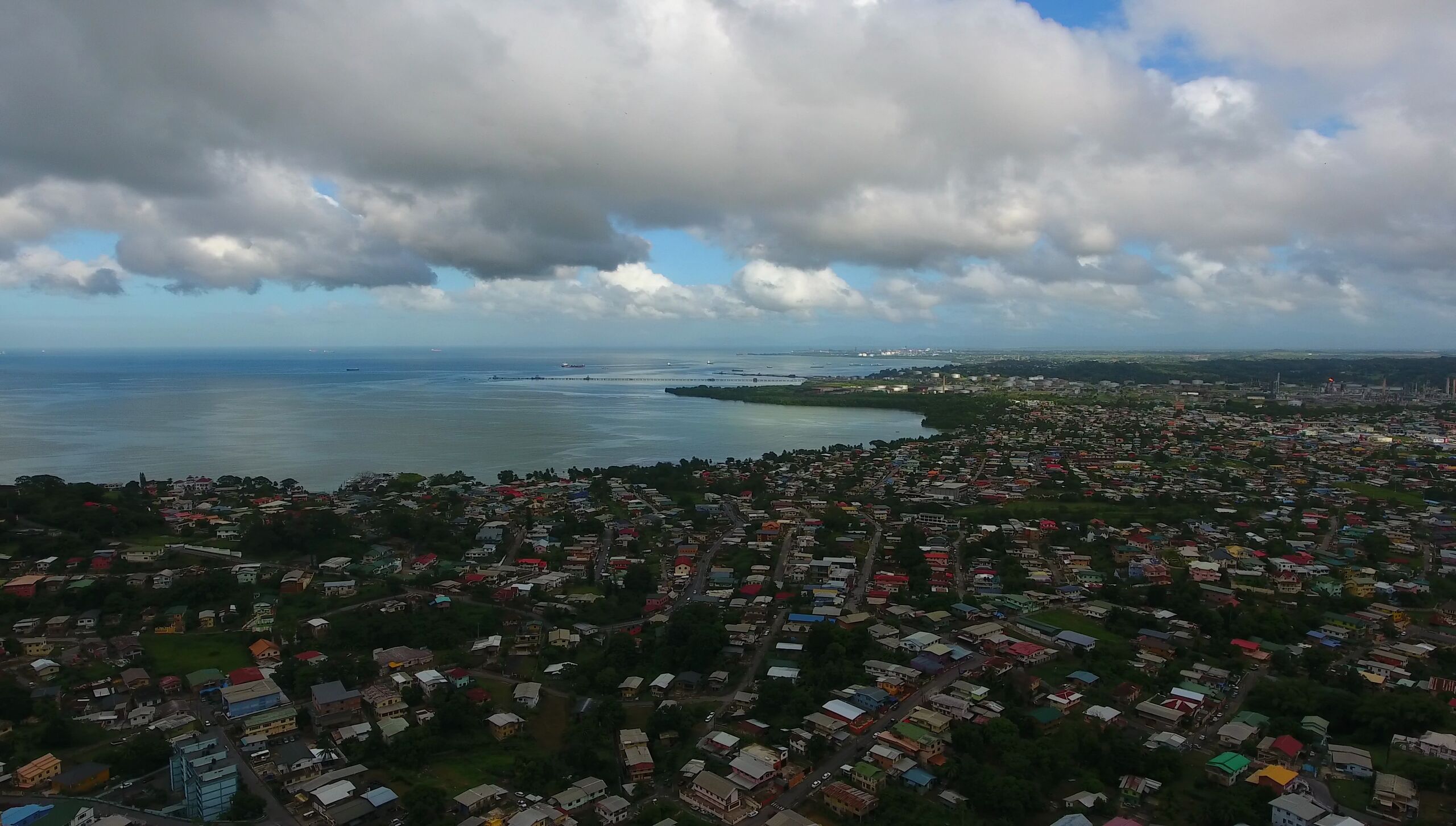
English: Marabella, San Fernando, Trinidad and Tobago.
In the background: The industrial areas of Pointe-à-Pierre. Top left: The Gulf of Paria. Technically Marabella is not a part of San Fernando, but it's administred by Princes Town instead. It is generally considered to be a suburb of San Fernando though. Photo taken as part of the Southern Trinidad Aerial Photo Project, a small project sponsored by WMDE. Drone used: DJI Phantom 4. Snapshot taken from video footage via VLC. |
| ⧼wm-license-information-date⧽ | 2016 |
| ⧼wm-license-information-source⧽ | ⧼Wm-license-own-work⧽ |
| ⧼wm-license-information-author⧽ | Grueslayer |
10°18′07″N 61°26′57″W / 10.30184°N 61.449116°W
ترخيص
|
تاريخ الملف
اضغط على زمن/تاريخ لرؤية الملف كما بدا في هذا الزمن.
| زمن/تاريخ | صورة مصغرة | الأبعاد | مستخدم | تعليق | |
|---|---|---|---|---|---|
| حالي | ★ مراجعة معتمدة 14:45، 21 أكتوبر 2023 | | 3٬840 × 2٬178 (4٫06 ميجابايت) | Pastakhov (نقاش | مساهمات) | Upload https://upload.wikimedia.org/wikipedia/commons/0/04/STAPP_030_San_Fernando_Marabella.jpg |
لا يمكنك استبدال هذا الملف.
وصلات
لا يوجد صفحات تصل لهذه الصورة.