ملف:River Glenderamackin - geograph.org.uk - 631030.jpg
لا توجد دقة أعلى متوفرة.
River_Glenderamackin_-_geograph.org.uk_-_631030.jpg (640 × 480 بكسل حجم الملف: 107 كيلوبايت، نوع MIME: image/jpeg)
وصف قصير
| ⧼wm-license-information-description⧽ |
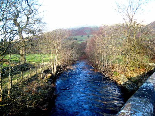
English: River Glenderamackin Just above the confluence with St John's Beck to form the River Greta. Seen from Townfield Bridge on the B5322. The slopes of Blencathra can be seen in the distance.
|
| ⧼wm-license-information-date⧽ | 2007 |
| ⧼wm-license-information-source⧽ | From geograph.org.uk |
| ⧼wm-license-information-author⧽ | Oliver Dixon |
| ⧼wm-license-cc-attribution⧽ (قالب:I18n/Credit line) |
Oliver Dixon / River Glenderamackin / |
54°36′51″N 3°03′20″W / 54.61424°N 3.0555°W قالب:Object location
_heading:337)
ترخيص
تاريخ الملف
اضغط على زمن/تاريخ لرؤية الملف كما بدا في هذا الزمن.
| زمن/تاريخ | صورة مصغرة | الأبعاد | مستخدم | تعليق | |
|---|---|---|---|---|---|
| حالي | ★ مراجعة معتمدة 16:13، 13 أكتوبر 2023 | | 640 × 480 (107 كيلوبايت) | Pastakhov (نقاش | مساهمات) | Upload https://upload.wikimedia.org/wikipedia/commons/5/57/River_Glenderamackin_-_geograph.org.uk_-_631030.jpg |
لا يمكنك استبدال هذا الملف.
وصلات
لا يوجد صفحات تصل لهذه الصورة.