ملف:Republic of Moldova Map of the regions affected by COVID-19.svg

حجم معاينة PNG لذلك الملف ذي الامتداد SVG: 394 × 493 بكسل. البعد الآخر: 1٬637 × 2٬048 بكسل.
الملف الأصلي (ملف SVG، أبعاده 394 × 493 بكسل، حجم الملف: 877 كيلوبايت)
وصف قصير
| ⧼wm-license-information-description⧽ |
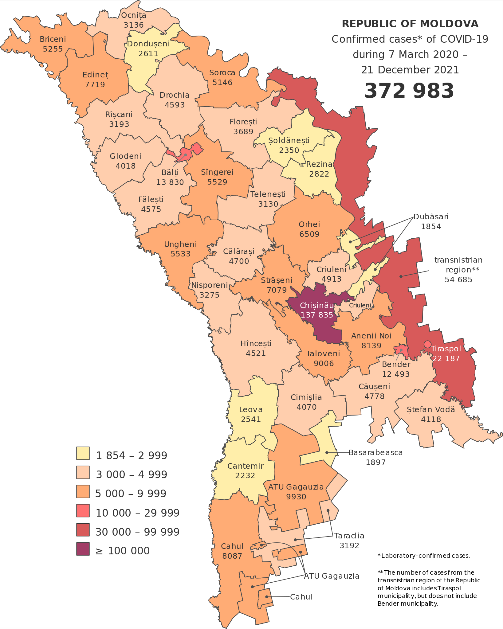
English: The map was created with Inkscape (https://inkscape.org/).
The borders were generated from https://wambachers-osm.website/boundaries/. Data source: http://gismoldova.maps.arcgis.com/apps/opsdashboard/index.html? |
| ⧼wm-license-information-date⧽ | 2020 |
| ⧼wm-license-information-source⧽ | ⧼Wm-license-own-work⧽ |
| ⧼wm-license-information-author⧽ | MD-wiki-user |
| ⧼wm-license-information-other-versions⧽ |
Deprecated (not maintained):
|
ترخيص
|
تاريخ الملف
اضغط على زمن/تاريخ لرؤية الملف كما بدا في هذا الزمن.
| زمن/تاريخ | صورة مصغرة | الأبعاد | مستخدم | تعليق | |
|---|---|---|---|---|---|
| حالي | ★ مراجعة معتمدة 21:53، 25 أكتوبر 2023 | | 394 × 493 (877 كيلوبايت) | Pastakhov (نقاش | مساهمات) | Upload https://upload.wikimedia.org/wikipedia/commons/6/66/Republic_of_Moldova_Map_of_the_regions_affected_by_COVID-19.svg |
لا يمكنك استبدال هذا الملف.
وصلات
لا يوجد صفحات تصل لهذه الصورة.