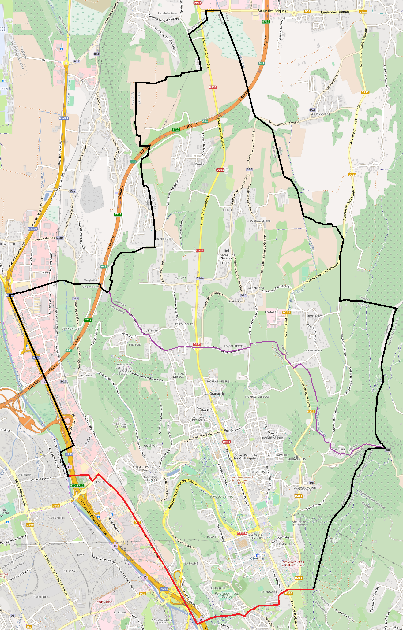
ملف:Plan - Canton de Chambéry-Nord-Sonnaz (2015).png
حجم هذه المعاينة: 383 × 600 بكسل. البعد الآخر: 1٬316 × 2٬060 بكسل.
الملف الأصلي (1٬316 × 2٬060 بكسل حجم الملف: 2٫4 ميجابايت، نوع MIME: image/png)
وصف قصير
| ⧼wm-license-information-description⧽ | |
| ⧼wm-license-information-date⧽ | 2015 |
| ⧼wm-license-information-source⧽ | ⧼Wm-license-own-work⧽ |
| ⧼wm-license-information-author⧽ | Open Street Map contributors / Florian Pépellin for the boundaries Contributeurs à Open Street Map / Florian Pépellin pour les limites |
| ⧼wm-license-information-permission⧽ (⧼wm-license-information-permission-reusing-text⧽) |
OpenStreetMap data is available under the Open Database License (details). Map tiles are licensed under the Creative Commons Attribution-ShareAlike 2.0 license (CC-BY-SA 2.0). قالب:ODbL OpenStreetMap |
تاريخ الملف
اضغط على زمن/تاريخ لرؤية الملف كما بدا في هذا الزمن.
| زمن/تاريخ | صورة مصغرة | الأبعاد | مستخدم | تعليق | |
|---|---|---|---|---|---|
| حالي | ★ مراجعة معتمدة 20:23، 4 أكتوبر 2023 | | 1٬316 × 2٬060 (2٫4 ميجابايت) | Pastakhov (نقاش | مساهمات) | Upload https://upload.wikimedia.org/wikipedia/commons/f/f6/Plan_-_Canton_de_Chamb%C3%A9ry-Nord-Sonnaz_%282015%29.png |
لا يمكنك استبدال هذا الملف.
وصلات
لا يوجد صفحات تصل لهذه الصورة.
.png&oldid=2976120)