ملف:Padre Island National Seashore - NPS map.jpg
حجم هذه المعاينة: 592 × 599 بكسل. البعد الآخر: 737 × 746 بكسل.
الملف الأصلي (737 × 746 بكسل حجم الملف: 60 كيلوبايت، نوع MIME: image/jpeg)
| ⧼wm-license-information-description⧽ |
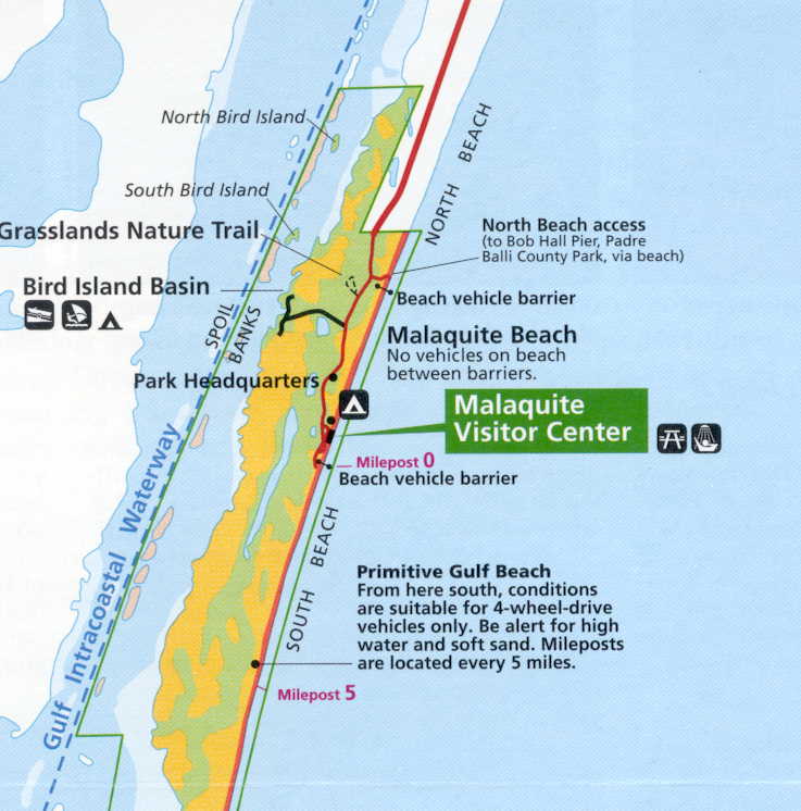
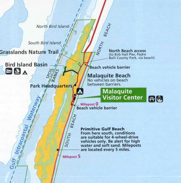
Photos and maps related to Padre Island. Padre Island National Seashore - NPS map |
| ⧼wm-license-information-date⧽ | 2006 |
| ⧼wm-license-information-source⧽ | United States Government (USGS, Dept of Ag, NOAA, NPS, FAA) |
| ⧼wm-license-information-author⧽ | uploaded by Johntex |
| ⧼wm-license-information-permission⧽ (⧼wm-license-information-permission-reusing-text⧽) |
Original work of the US Federal Government - public domain |

|
تاريخ الملف
اضغط على زمن/تاريخ لرؤية الملف كما بدا في هذا الزمن.
| زمن/تاريخ | صورة مصغرة | الأبعاد | مستخدم | تعليق | |
|---|---|---|---|---|---|
| حالي | ★ مراجعة معتمدة 00:05، 22 أكتوبر 2023 | | 737 × 746 (60 كيلوبايت) | Pastakhov (نقاش | مساهمات) | Upload https://upload.wikimedia.org/wikipedia/commons/e/e7/Padre_Island_National_Seashore_-_NPS_map.jpg |
لا يمكنك استبدال هذا الملف.
وصلات
لا يوجد صفحات تصل لهذه الصورة.