ملف:Ordnance Survey Map of the Antonine Wall, Published 1969.jpg

حجم هذه المعاينة: 750 × 599 بكسل. البعدان الآخران: 2٬560 × 2٬046 بكسل | 12٬242 × 9٬784 بكسل.
الملف الأصلي (12٬242 × 9٬784 بكسل حجم الملف: 50 ميجابايت، نوع MIME: image/jpeg)
وصف قصير
| ⧼wm-license-information-description⧽ |
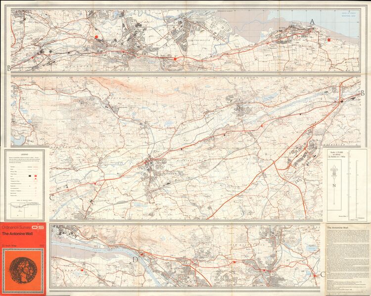
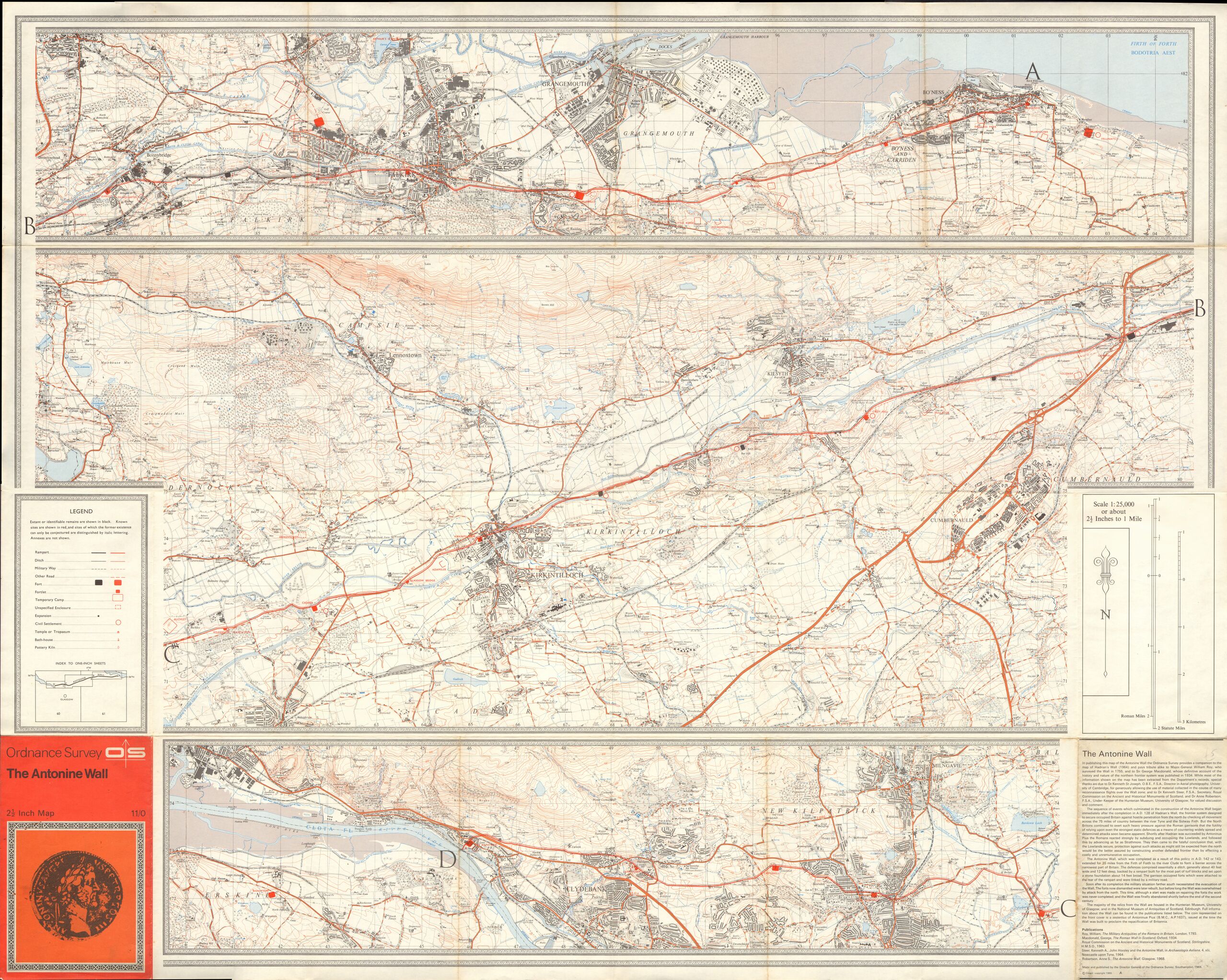
English: OS Map of the Antonine Wall, in Southern Scotland, at a scale of 1:25,000 or about 2.5 inches to one mile.
|
| ⧼wm-license-information-date⧽ | 1969 |
| ⧼wm-license-information-source⧽ | Scan of original OS map |
| ⧼wm-license-information-author⧽ | Director General of the Ordnance Survey, UK |
| ⧼wm-license-information-other-versions⧽ |
ترخيص
تاريخ الملف
اضغط على زمن/تاريخ لرؤية الملف كما بدا في هذا الزمن.
| زمن/تاريخ | صورة مصغرة | الأبعاد | مستخدم | تعليق | |
|---|---|---|---|---|---|
| حالي | ★ مراجعة معتمدة 09:48، 25 أكتوبر 2023 | | 12٬242 × 9٬784 (50 ميجابايت) | Pastakhov (نقاش | مساهمات) | Upload https://upload.wikimedia.org/wikipedia/commons/1/18/Ordnance_Survey_Map_of_the_Antonine_Wall%2C_Published_1969.jpg |
لا يمكنك استبدال هذا الملف.
وصلات
لا يوجد صفحات تصل لهذه الصورة.