ملف:Ogallala saturated thickness 1997-sattk97-v2.svg

حجم معاينة PNG لذلك الملف ذي الامتداد SVG: 410 × 600 بكسل. البعد الآخر: 1٬399 × 2٬048 بكسل.
الملف الأصلي (ملف SVG، أبعاده 656 × 960 بكسل، حجم الملف: 1٫36 ميجابايت)
وصف قصير
| ⧼wm-license-information-description⧽ |
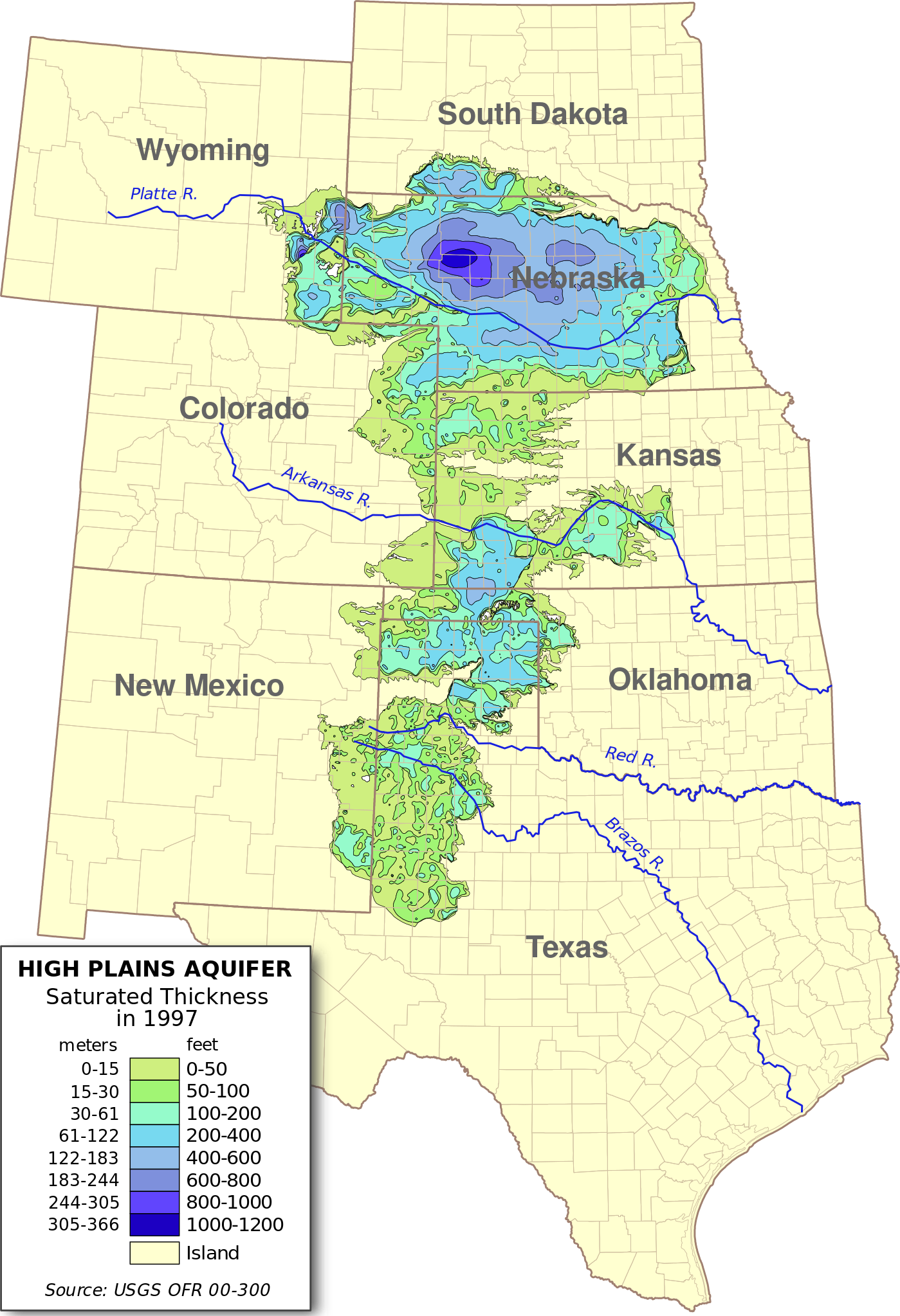
English: Digital map of the saturated thickness of the High Plains aquifer in parts of Kansas, Nebraska, New Mexico, Oklahoma, South Dakota, Texas and Wyoming, 1996-97.
Produced from GIS data produced by the USGS and published in Open File Report 00-300 (USGS OFR 00-300)[1]. Researchers: Fischer, Brian C.; Kollasch, Keith M.; McGuire, Virginia L.
|
| ⧼wm-license-information-date⧽ | 2009 |
| ⧼wm-license-information-source⧽ | ⧼Wm-license-own-work⧽ |
| ⧼wm-license-information-author⧽ | Kbh3rd |
| ⧼wm-license-information-other-versions⧽ |
ترخيص
|

تاريخ الملف
اضغط على زمن/تاريخ لرؤية الملف كما بدا في هذا الزمن.
| زمن/تاريخ | صورة مصغرة | الأبعاد | مستخدم | تعليق | |
|---|---|---|---|---|---|
| حالي | ★ مراجعة معتمدة 03:41، 4 ديسمبر 2023 | | 656 × 960 (1٫36 ميجابايت) | Pastakhov (نقاش | مساهمات) | Upload https://upload.wikimedia.org/wikipedia/commons/4/44/Ogallala_saturated_thickness_1997-sattk97-v2.svg |
لا يمكنك استبدال هذا الملف.
وصلات
لا يوجد صفحات تصل لهذه الصورة.