ملف:NggelaSolomons.png
لا توجد دقة أعلى متوفرة.
NggelaSolomons.png (534 × 453 بكسل حجم الملف: 8 كيلوبايت، نوع MIME: image/png)
وصف قصير
| ⧼wm-license-information-description⧽ |
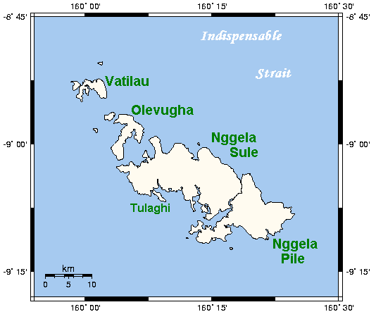
Map of the Nggela Islands (Floridas Islands) — of the Solomon Islands archipelago, in the Solomon Islands (country).
|
| ⧼wm-license-information-date⧽ | قالب:Original upload date |
| ⧼wm-license-information-source⧽ | قالب:Transferred from |
| ⧼wm-license-information-author⧽ | قالب:User at project |
ترخيص
قالب:GFDL-user-en-with-disclaimers
قالب:Original upload log
قالب:Original description page
- 2006-04-13 22:34 Kelisi 534×453×8 (8041 bytes) Map of Nggela/Florida Islands, Solomon Islands. This map's source is [http://www.aquarius.geomar.de/omc/make_map.html here], with the uploader's modifications, and the [http://gmt.soest.hawaii.edu/ GMT homepage] says that the tools are released under the
تاريخ الملف
اضغط على زمن/تاريخ لرؤية الملف كما بدا في هذا الزمن.
| زمن/تاريخ | صورة مصغرة | الأبعاد | مستخدم | تعليق | |
|---|---|---|---|---|---|
| حالي | ★ مراجعة معتمدة 01:37، 12 نوفمبر 2023 | | 534 × 453 (8 كيلوبايت) | Pastakhov (نقاش | مساهمات) | Upload https://upload.wikimedia.org/wikipedia/commons/7/74/NggelaSolomons.png |
لا يمكنك استبدال هذا الملف.
وصلات
لا يوجد صفحات تصل لهذه الصورة.