ملف:Mexico Veracruz Papaloapan Region location map.svg

حجم معاينة PNG لذلك الملف ذي الامتداد SVG: 576 × 600 بكسل. البعد الآخر: 1٬966 × 2٬048 بكسل.
الملف الأصلي (ملف SVG، أبعاده 2٬404 × 2٬504 بكسل، حجم الملف: 2٫46 ميجابايت)
وصف قصير
| ⧼wm-license-information-description⧽ |
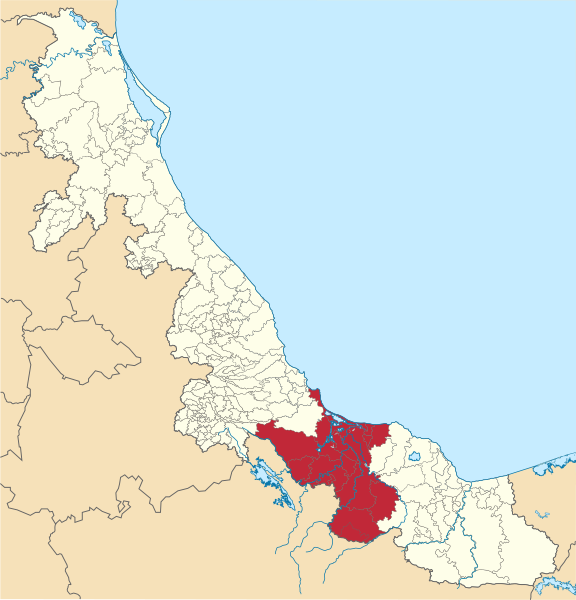
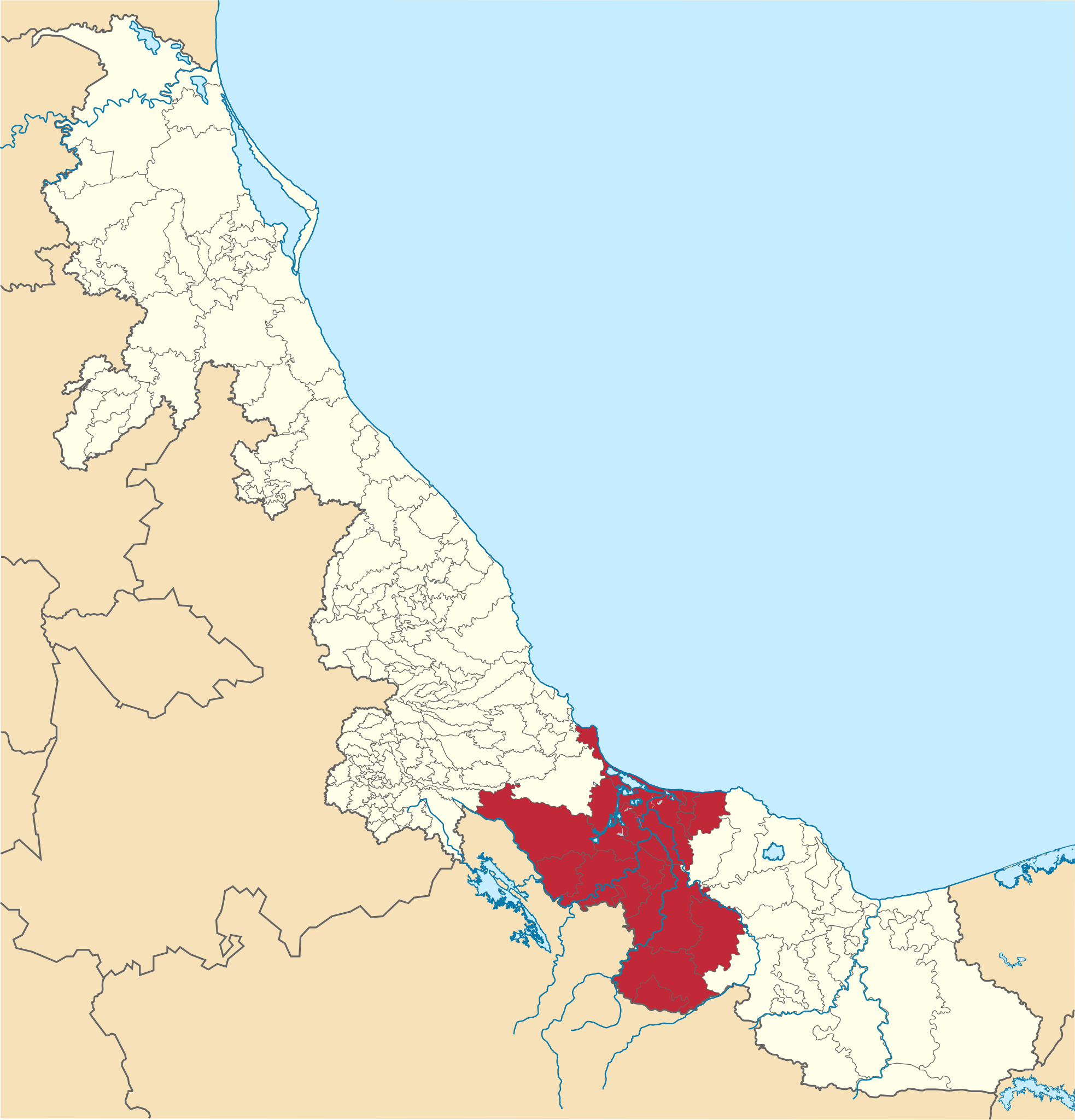
English: Map with the municipalities encompassing the Papaloapan Region in the State of Veracruz
Español: Mapa con los municipios que conforman la Región del Papaloapan en el Estado de Veracruz.
|
| ⧼wm-license-information-date⧽ | 2022 |
| ⧼wm-license-information-source⧽ | ⧼Wm-license-own-work⧽ |
| ⧼wm-license-information-author⧽ | EOZyo |
ترخيص
|
تاريخ الملف
اضغط على زمن/تاريخ لرؤية الملف كما بدا في هذا الزمن.
| زمن/تاريخ | صورة مصغرة | الأبعاد | مستخدم | تعليق | |
|---|---|---|---|---|---|
| حالي | ★ مراجعة معتمدة 16:52، 18 ديسمبر 2023 | | 2٬404 × 2٬504 (2٫46 ميجابايت) | Pastakhov (نقاش | مساهمات) | Upload https://upload.wikimedia.org/wikipedia/commons/d/d4/Mexico_Veracruz_Papaloapan_Region_location_map.svg |
لا يمكنك استبدال هذا الملف.
وصلات
لا يوجد صفحات تصل لهذه الصورة.