ملف:Mecklenburg-Vorpommern NB 2011.svg

حجم معاينة PNG لذلك الملف ذي الامتداد SVG: 800 × 549 بكسل. البعد الآخر: 2٬560 × 1٬757 بكسل.
الملف الأصلي (ملف SVG، أبعاده 1٬129 × 775 بكسل، حجم الملف: 1٫55 ميجابايت)
وصف قصير
| ⧼wm-license-information-description⧽ |
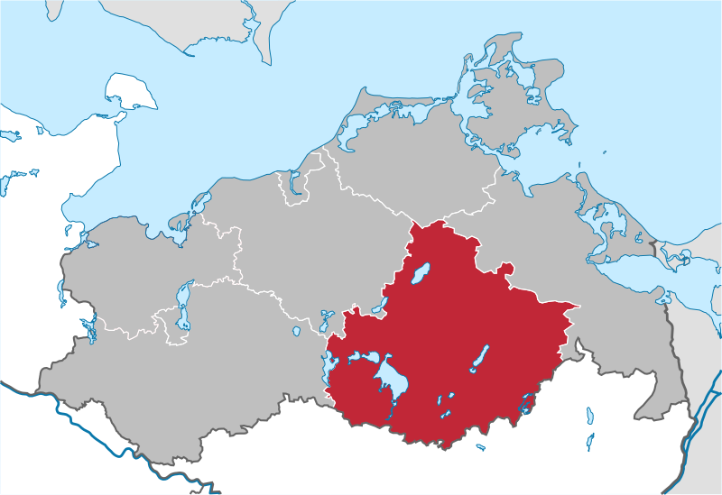
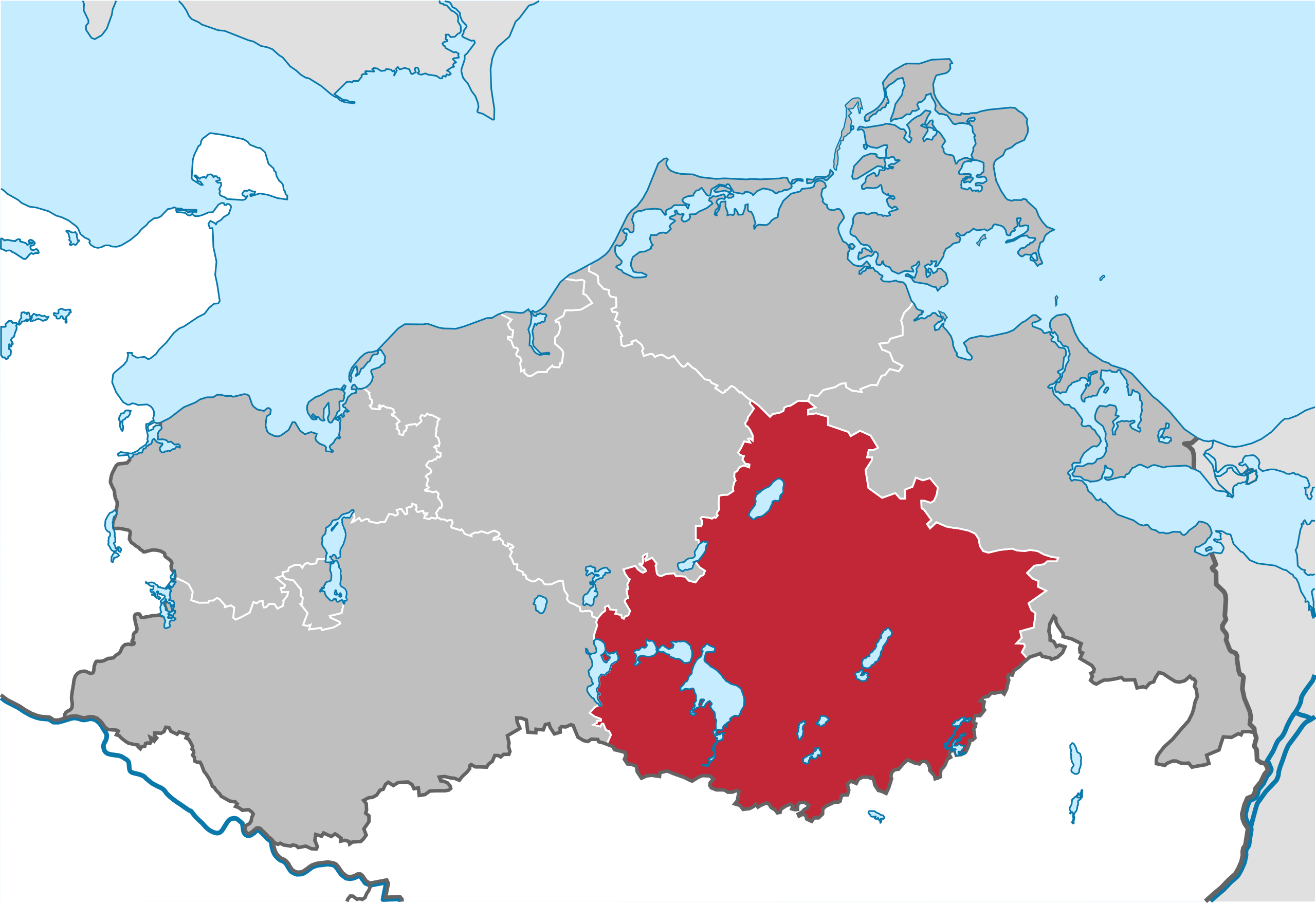
Deutsch: Lage von Landkreis Mecklenburgische Seenplatte in Mecklenburg-Vorpommern, Deutschland nach der Kreisgebietsreform 2011
English: Locator map of Landkreis Mecklenburgische Seenplatte in Mecklenburg-Vorpommern, Germany after county reorganization 2011.
|
| ⧼wm-license-information-date⧽ | 2009 |
| ⧼wm-license-information-source⧽ | قالب:Adobe Illustrator
⧼Wm-license-own-work⧽, based on: |
| ⧼wm-license-information-author⧽ | قالب:TUBS |
ترخيص
|

|

تاريخ الملف
اضغط على زمن/تاريخ لرؤية الملف كما بدا في هذا الزمن.
| زمن/تاريخ | صورة مصغرة | الأبعاد | مستخدم | تعليق | |
|---|---|---|---|---|---|
| حالي | ★ مراجعة معتمدة 21:06، 16 أكتوبر 2023 | | 1٬129 × 775 (1٫55 ميجابايت) | Pastakhov (نقاش | مساهمات) | Upload https://upload.wikimedia.org/wikipedia/commons/6/6f/Mecklenburg-Vorpommern_NB_2011.svg |
لا يمكنك استبدال هذا الملف.
وصلات
لا يوجد صفحات تصل لهذه الصورة.