ملف:Massif du Giffre.jpg

حجم هذه المعاينة: 800 × 400 بكسل. البعد الآخر: 2٬688 × 1٬344 بكسل.
الملف الأصلي (2٬688 × 1٬344 بكسل حجم الملف: 959 كيلوبايت، نوع MIME: image/jpeg)
وصف قصير
| ⧼wm-license-information-description⧽ |
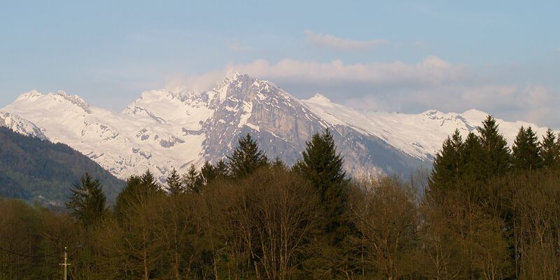
English: Massif du Giffre (Haute Savoie), viewed from the Avenue des Thezieres in front of the municipal campsite at Taninges.
Français : Massif du Giffre (Haute Savoie) - de gauche a droite:
Pointe Rousse des Chambres et le Rochers de la Couarra, massif du Criou (avec au premier plan, l'Aouille), derrière (dans les nuages) les Avoudrues, Pointe de Ressachat.
|
| ⧼wm-license-information-date⧽ | 2008, {{time}} – invalid date format 41 (help) |
| ⧼wm-license-information-source⧽ | ⧼Wm-license-own-work⧽ |
| ⧼wm-license-information-author⧽ | Tijs Michels |
| ⧼wm-license-information-permission⧽ (⧼wm-license-information-permission-reusing-text⧽) |
cc-by-sa-3.0 (see below) |
46°05′57.84″N 6°35′25.08″E / 46.0994000°N 6.5903000°E
ترخيص
|

تاريخ الملف
اضغط على زمن/تاريخ لرؤية الملف كما بدا في هذا الزمن.
| زمن/تاريخ | صورة مصغرة | الأبعاد | مستخدم | تعليق | |
|---|---|---|---|---|---|
| حالي | ★ مراجعة معتمدة 08:49، 14 نوفمبر 2023 | | 2٬688 × 1٬344 (959 كيلوبايت) | Pastakhov (نقاش | مساهمات) | Upload https://upload.wikimedia.org/wikipedia/commons/5/53/Massif_du_Giffre.jpg |
لا يمكنك استبدال هذا الملف.
وصلات
لا يوجد صفحات تصل لهذه الصورة.