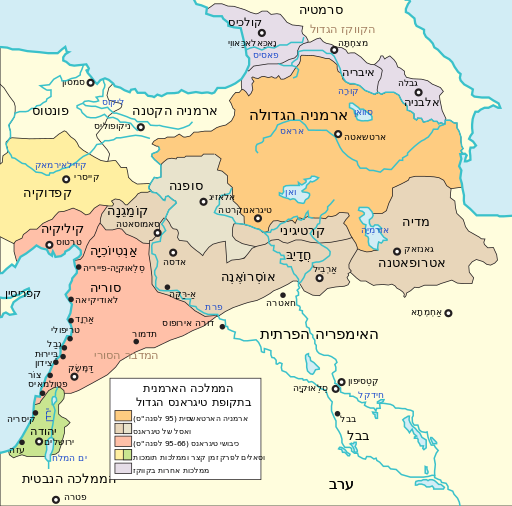
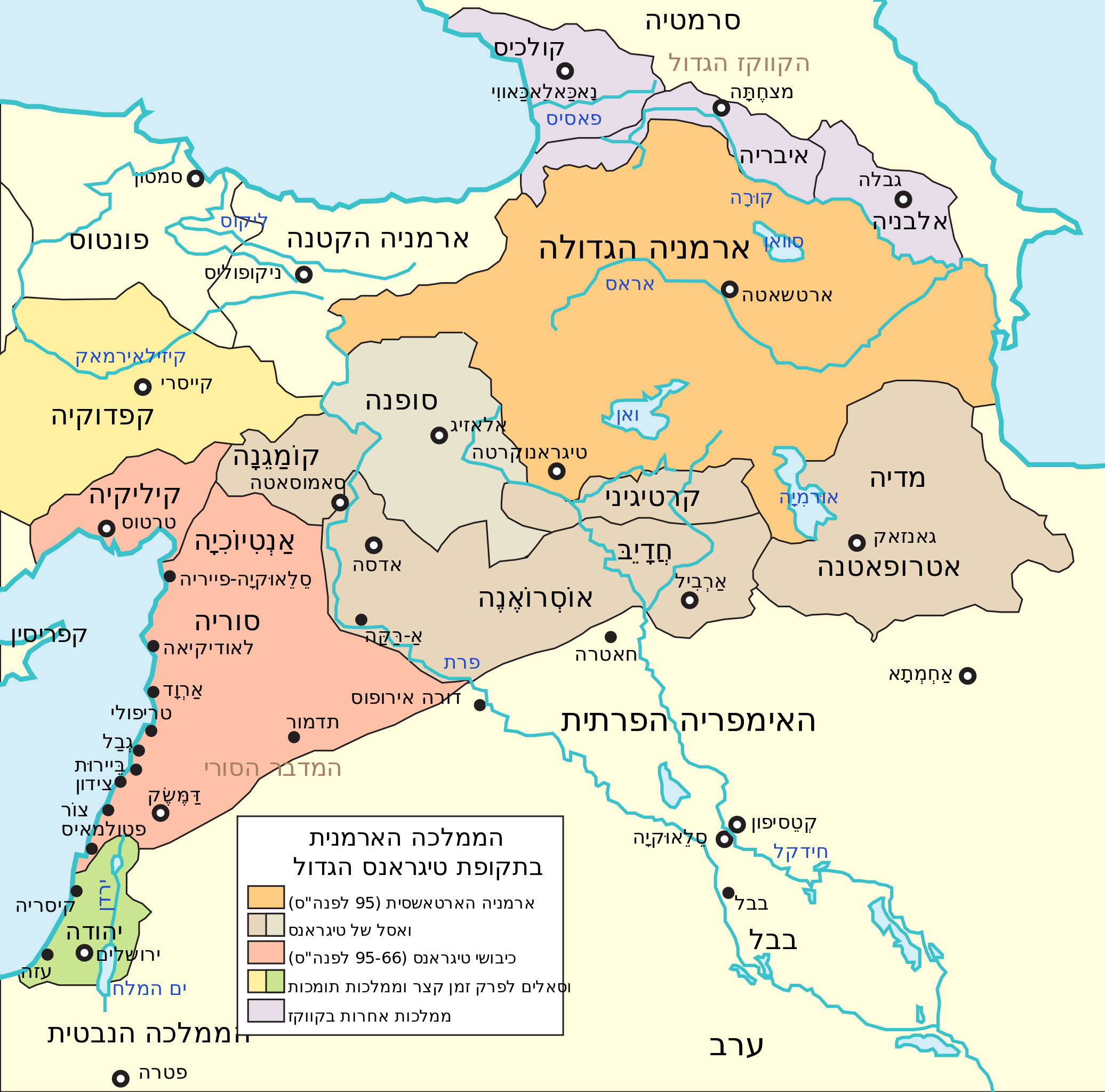
ملف:Maps of the Armenian Empire of Tigranes-he.svg

حجم معاينة PNG لذلك الملف ذي الامتداد SVG: 512 × 506 بكسل. البعد الآخر: 2٬072 × 2٬048 بكسل.
الملف الأصلي (ملف SVG، أبعاده 512 × 506 بكسل، حجم الملف: 38 كيلوبايت)
وصف قصير
| ⧼wm-license-information-description⧽ |
بالعبرية: מפת ארמניה בתקופת טיגראנס הגדול (Portuguese) |
| ⧼wm-license-information-date⧽ | 2014, {{time}} – invalid date format 38 (help) |
| ⧼wm-license-information-source⧽ | |
| ⧼wm-license-information-author⧽ |
|
| ⧼wm-license-information-other-versions⧽ |
| [This is a retouched picture, which means that it has been digitally altered from its original version. Modifications: Translate to Hebrew and map correction. The original can be viewed here: Maps of the Armenian Empire of Tigranes-pt.svg. Modifications made by Geagea.] Error: {{Lang}}: text has italic markup (help)
|
ترخيص
تاريخ الملف
اضغط على زمن/تاريخ لرؤية الملف كما بدا في هذا الزمن.
| زمن/تاريخ | صورة مصغرة | الأبعاد | مستخدم | تعليق | |
|---|---|---|---|---|---|
| حالي | ★ مراجعة معتمدة 00:42، 9 أكتوبر 2023 | | 512 × 506 (38 كيلوبايت) | Pastakhov (نقاش | مساهمات) | Upload https://upload.wikimedia.org/wikipedia/commons/5/5c/Maps_of_the_Armenian_Empire_of_Tigranes-he.svg |
لا يمكنك استبدال هذا الملف.
وصلات
لا يوجد صفحات تصل لهذه الصورة.