ملف:Map of the Encirclement of Port Arthur.jpg
حجم هذه المعاينة: 464 × 599 بكسل. البعد الآخر: 1٬686 × 2٬178 بكسل.
الملف الأصلي (1٬686 × 2٬178 بكسل حجم الملف: 645 كيلوبايت، نوع MIME: image/jpeg)
| ⧼wm-license-information-description⧽ |
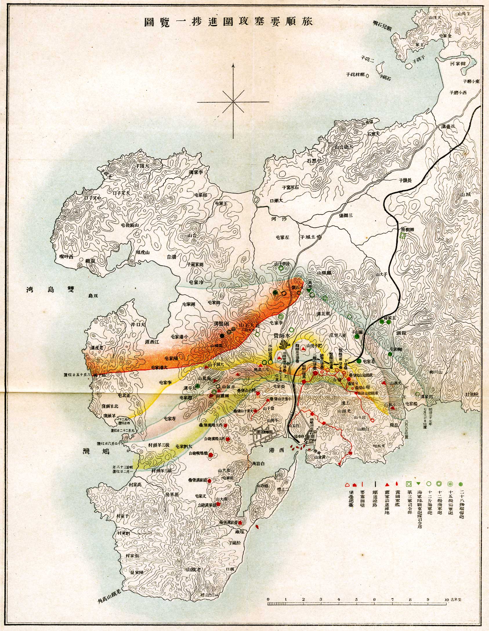
(Japanese) English: Map of the Encirclement of Port Arthur Fortification
|
| ⧼wm-license-information-date⧽ | (Japanese) English: November 25, 1909 |
| ⧼wm-license-information-source⧽ | (Japanese) English: Records of Naval Battles in Meiji 37th, 38th vol. 2 |
| ⧼wm-license-information-author⧽ | (Japanese) English: Imperial Japanese Navy General Staff |
Notes : (Japanese)
English: Japanese descriptions of this summary is taken from the source. This file was scanned and edited by the uploader, Amagase.
تاريخ الملف
اضغط على زمن/تاريخ لرؤية الملف كما بدا في هذا الزمن.
| زمن/تاريخ | صورة مصغرة | الأبعاد | مستخدم | تعليق | |
|---|---|---|---|---|---|
| حالي | ★ مراجعة معتمدة 11:29، 2 نوفمبر 2023 | | 1٬686 × 2٬178 (645 كيلوبايت) | Pastakhov (نقاش | مساهمات) | Upload https://upload.wikimedia.org/wikipedia/commons/3/3a/Map_of_the_Encirclement_of_Port_Arthur.jpg |
لا يمكنك استبدال هذا الملف.
وصلات
لا يوجد صفحات تصل لهذه الصورة.