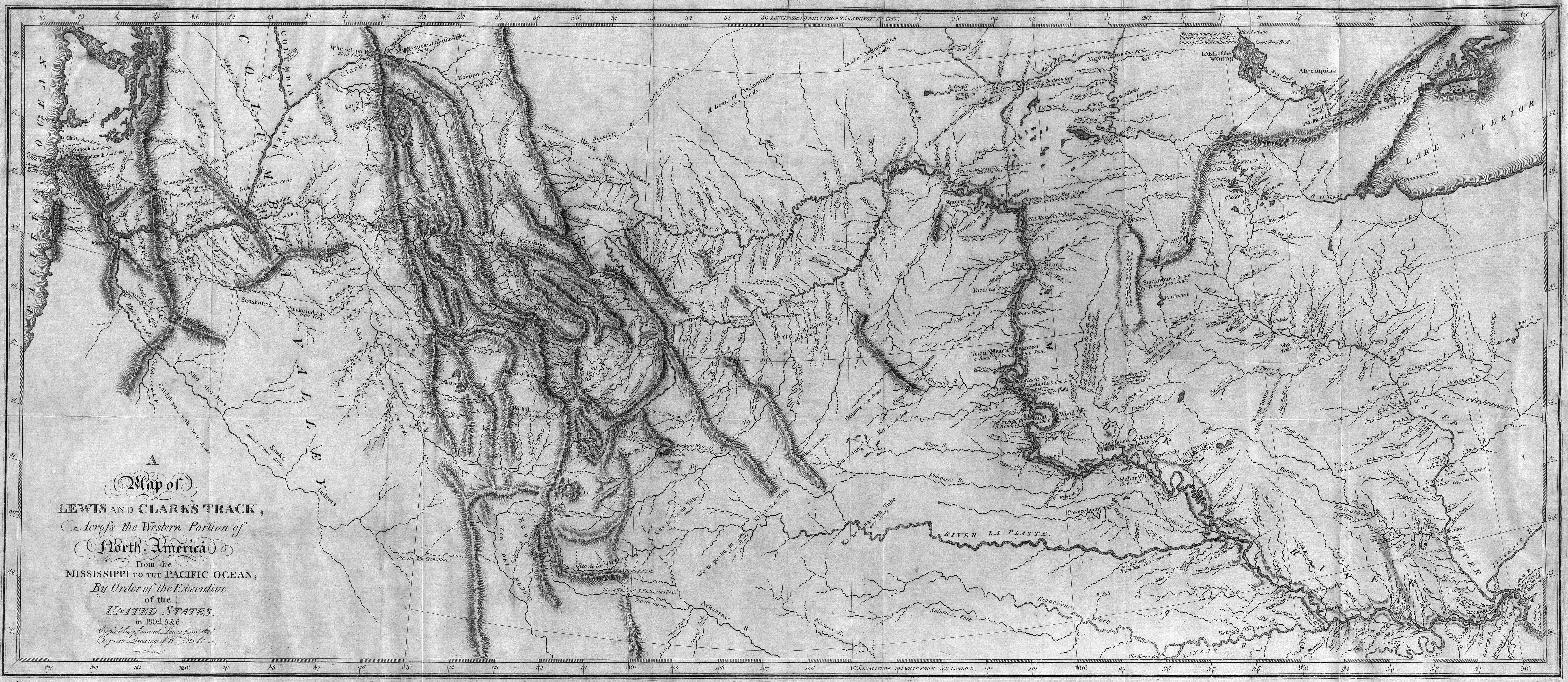
ملف:Map of Lewis and Clark's Track, Across the Western Portion of North America, published 1814.jpg
حجم هذه المعاينة: 800 × 348 بكسل. البعدان الآخران: 2٬560 × 1٬113 بكسل | 7٬000 × 3٬043 بكسل.
الملف الأصلي (7٬000 × 3٬043 بكسل حجم الملف: 10٫18 ميجابايت، نوع MIME: image/jpeg)
تاريخ الملف
اضغط على زمن/تاريخ لرؤية الملف كما بدا في هذا الزمن.
| زمن/تاريخ | صورة مصغرة | الأبعاد | مستخدم | تعليق | |
|---|---|---|---|---|---|
| حالي | 14:40، 8 أبريل 2012 | | 7٬000 × 3٬043 (10٫18 ميجابايت) | Shafei (نقاش | مساهمات) |
لا يمكنك استبدال هذا الملف.
وصلات
الصفحات التالية تحتوي على وصلة لهذه الصورة: