ملف:KureAtoll.jpg
حجم هذه المعاينة: 600 × 600 بكسل. البعد الآخر: 1٬000 × 1٬000 بكسل.
الملف الأصلي (1٬000 × 1٬000 بكسل حجم الملف: 427 كيلوبايت، نوع MIME: image/jpeg)
وصف قصير
| ⧼wm-license-information-description⧽ |
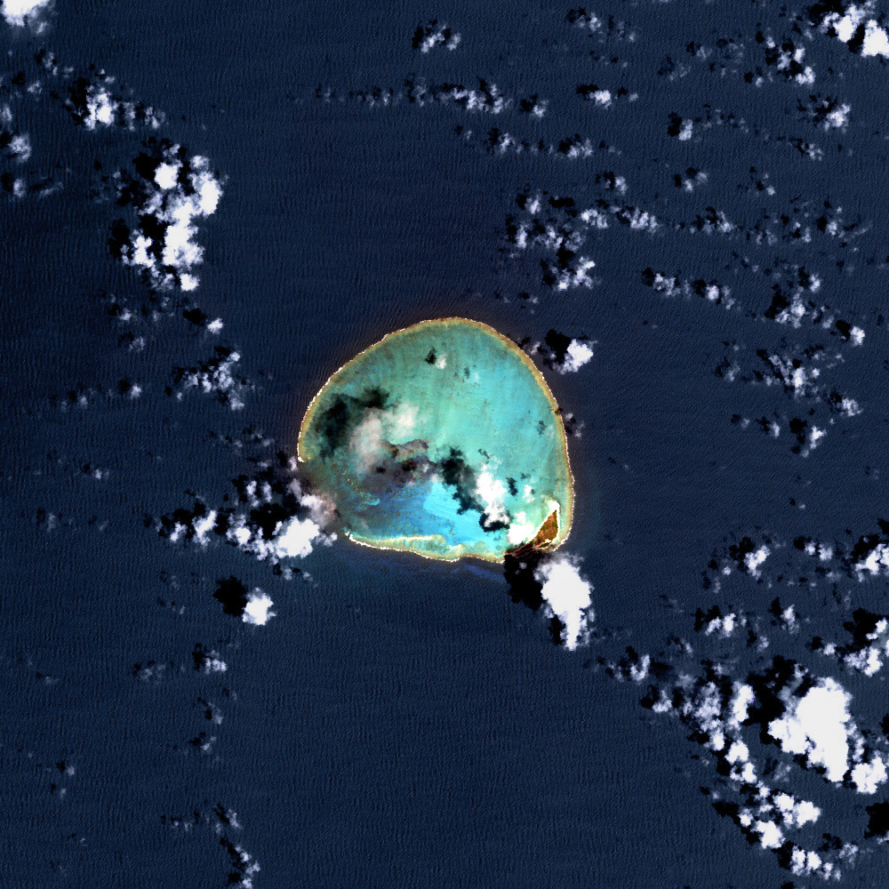
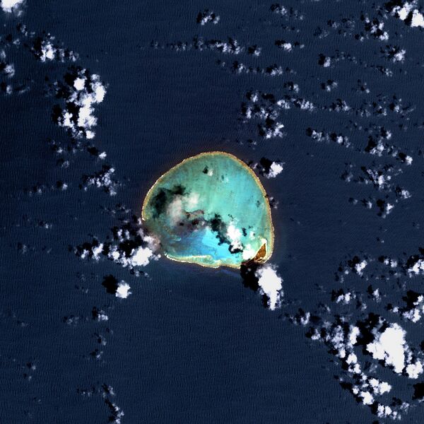
Deutsch: USGS-Landsat7-Satellitenbild des Kure-Atolls, Nordwestliche Hawaii-Inseln
English: Kure Atoll, Northwestern Hawaiian Islands - Satellite image from USGS' Landsat7 Satellite
|
| ⧼wm-license-information-date⧽ | تاريخ غير معروف |
| ⧼wm-license-information-source⧽ | http://www.hawaiireef.noaa.gov/imagery/rpa.html |
| ⧼wm-license-information-author⧽ | Landsat images were purchased by US Geological Survey |
ترخيص
قالب:Original upload log
- 03:11, 12 March 2006 . . SeanMD80 (Talk | contribs) . . 1000×1000 (556,540 bytes) (Satellite image from NASA's Landsat 7 satellite {PD-USGov-NASA} http://www.hawaiireef.noaa.gov/imagery/rpa.html )
تاريخ الملف
اضغط على زمن/تاريخ لرؤية الملف كما بدا في هذا الزمن.
| زمن/تاريخ | صورة مصغرة | الأبعاد | مستخدم | تعليق | |
|---|---|---|---|---|---|
| حالي | ★ مراجعة معتمدة 02:20، 30 أكتوبر 2023 | | 1٬000 × 1٬000 (427 كيلوبايت) | Pastakhov (نقاش | مساهمات) | Upload https://upload.wikimedia.org/wikipedia/commons/5/51/KureAtoll.jpg |
لا يمكنك استبدال هذا الملف.
وصلات
لا يوجد صفحات تصل لهذه الصورة.