ملف:Karst Hydrogeologie Schema1.jpg
حجم هذه المعاينة: 800 × 533 بكسل. البعد الآخر: 1٬800 × 1٬200 بكسل.
الملف الأصلي (1٬800 × 1٬200 بكسل حجم الملف: 979 كيلوبايت، نوع MIME: image/jpeg)
| ⧼wm-license-information-description⧽ |
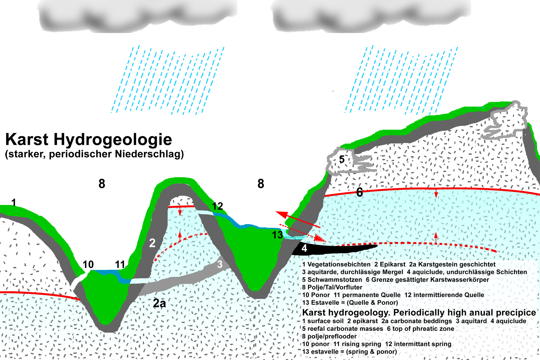
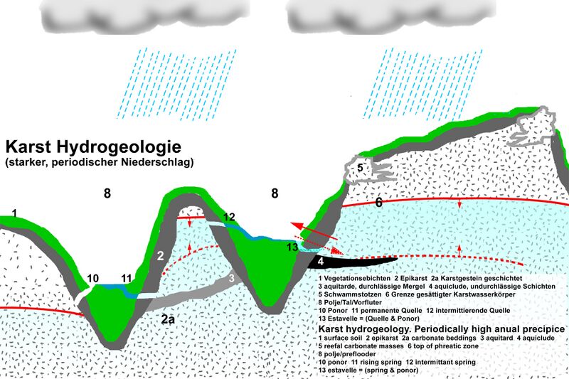
Deutsch: Hydrogeologisches Schema: Beispiel starke Verkarstung und normaler oder starker periodischer Niederschlag. Wenn der Level der Phreatischen Zone (wassergesättigte Gesteinszone) stark schwankt, kann auch eine Estavelle möglich sein (13). English: Hydrogeologic schema of karstwater systems.
When precipitation is seasonally high, as this may apear in parts of the Alps and the Dinaric Alps (esp. Orjen with annual average precipitation of up to 6500 mm) Estavelles are possible. In both mountain chains this rare phenomenon exists. An estavelle can either serve as a ponor or as a karst spring, depending on whether the phreatic karst zone is low or high. |
| ⧼wm-license-information-date⧽ | 2010 |
| ⧼wm-license-information-source⧽ | see author |
| ⧼wm-license-information-author⧽ | ulrichstill |
تاريخ الملف
اضغط على زمن/تاريخ لرؤية الملف كما بدا في هذا الزمن.
| زمن/تاريخ | صورة مصغرة | الأبعاد | مستخدم | تعليق | |
|---|---|---|---|---|---|
| حالي | ★ مراجعة معتمدة 22:41، 15 نوفمبر 2023 | | 1٬800 × 1٬200 (979 كيلوبايت) | Pastakhov (نقاش | مساهمات) | Upload https://upload.wikimedia.org/wikipedia/commons/9/9e/Karst_Hydrogeologie_Schema1.jpg |
لا يمكنك استبدال هذا الملف.
وصلات
لا يوجد صفحات تصل لهذه الصورة.