ملف:Kab 1500-1750.png
حجم هذه المعاينة: 800 × 521 بكسل. البعدان الآخران: 2٬560 × 1٬669 بكسل | 6٬792 × 4٬427 بكسل.
الملف الأصلي (6٬792 × 4٬427 بكسل حجم الملف: 2٫9 ميجابايت، نوع MIME: image/png)
وصف قصير
| ⧼wm-license-information-description⧽ |
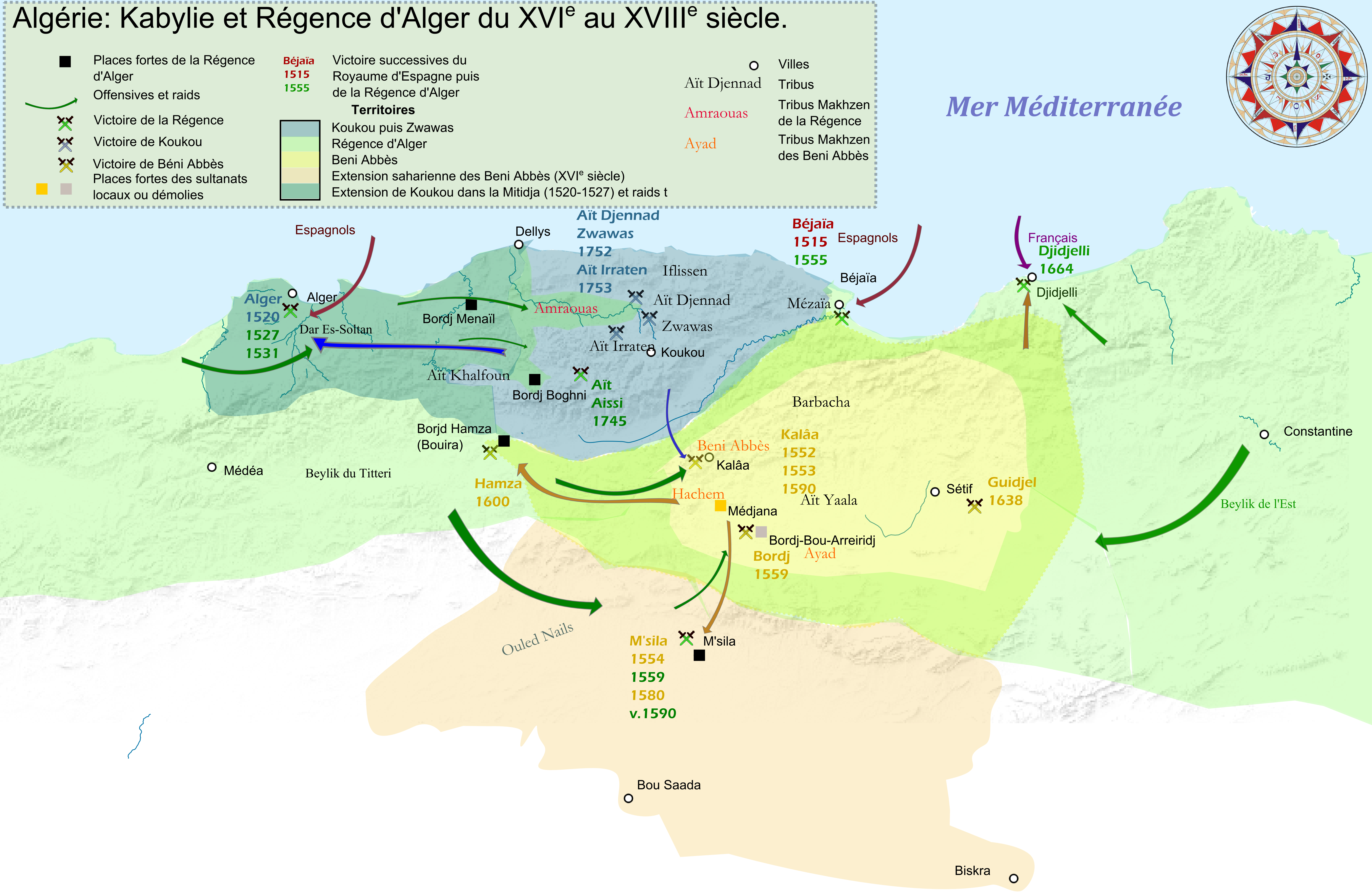
English: Historic map of Kingdom Beni Abbès and Koukou.
Based on : -Euratlas -Louis Rinn ( HISTOIRE DE L’INSURRECTION DE 1871 EN ALGÉRIE) : introduction -Revue africaine, Numéros 97 à 108 (Livre numérique Google) |
| ⧼wm-license-information-date⧽ | 2014, {{time}} – invalid date format 46 (help) |
| ⧼wm-license-information-source⧽ | ⧼Wm-license-own-work⧽ |
| ⧼wm-license-information-author⧽ | Kabyle20 |
ترخيص
|
تاريخ الملف
اضغط على زمن/تاريخ لرؤية الملف كما بدا في هذا الزمن.
| زمن/تاريخ | صورة مصغرة | الأبعاد | مستخدم | تعليق | |
|---|---|---|---|---|---|
| حالي | ★ مراجعة معتمدة 05:25، 21 أكتوبر 2023 | | 6٬792 × 4٬427 (2٫9 ميجابايت) | Pastakhov (نقاش | مساهمات) | Upload https://upload.wikimedia.org/wikipedia/commons/c/cb/Kab_1500-1750.png |
لا يمكنك استبدال هذا الملف.
وصلات
لا يوجد صفحات تصل لهذه الصورة.