ملف:Izarbeibarren mapa izenekin eta kokapena Euskal Herrian.svg

حجم معاينة PNG لذلك الملف ذي الامتداد SVG: 740 × 600 بكسل. البعد الآخر: 2٬528 × 2٬048 بكسل.
الملف الأصلي (ملف SVG، أبعاده 1٬144 × 927 بكسل، حجم الملف: 1٫41 ميجابايت)
| ⧼wm-license-information-description⧽ |
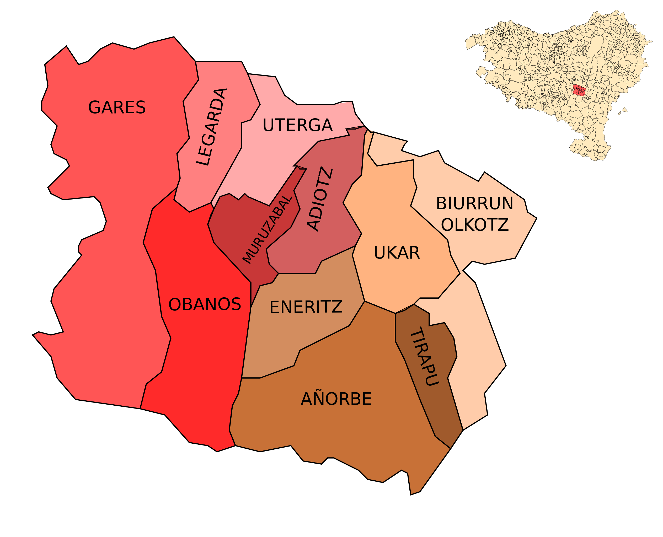
Izarbeibar valley location in the Basque Country, with name of the villages. |
| ⧼wm-license-information-date⧽ | 2008-09-11 20:23 (UTC) |
| ⧼wm-license-information-source⧽ | |
| ⧼wm-license-information-author⧽ |
|
| [This is a retouched picture, which means that it has been digitally altered from its original version. The original can be viewed here: Izarbeibarren_mapa_laua_eta_kokapena_Euskal_Herrian.svg.] Error: {{Lang}}: text has italic markup (help)
|
|

قالب:Original upload log
This image is a derivative work of the following images:
- Image:Izarbeibarren_mapa_laua_eta_kokapena_Euskal_Herrian.svg licensed with Cc-by-sa-2.5,2.0,1.0, GFDL
- 2008-09-11T19:33:46Z Theklan 1144x927 (1475089 Bytes) {{Information |Description=Izarbeibar valley location in the Basque Country |Source=*[[:Image:Euskal_Herria_municipalities.svg|]] |Date=2008-09-11 19:30 (UTC) |Author=*derivative work: ~~~ *[[:Image:Euskal_Herria_municipaliti
تاريخ الملف
اضغط على زمن/تاريخ لرؤية الملف كما بدا في هذا الزمن.
| زمن/تاريخ | صورة مصغرة | الأبعاد | مستخدم | تعليق | |
|---|---|---|---|---|---|
| حالي | ★ مراجعة معتمدة 08:09، 5 ديسمبر 2023 | | 1٬144 × 927 (1٫41 ميجابايت) | Pastakhov (نقاش | مساهمات) | Upload https://upload.wikimedia.org/wikipedia/commons/9/98/Izarbeibarren_mapa_izenekin_eta_kokapena_Euskal_Herrian.svg |
لا يمكنك استبدال هذا الملف.
وصلات
لا يوجد صفحات تصل لهذه الصورة.