ملف:Itaimbezinho - Parque Nacional Aparados da Serra 33.JPG
حجم هذه المعاينة: 800 × 533 بكسل. البعد الآخر: 3٬000 × 2٬000 بكسل.
الملف الأصلي (3٬000 × 2٬000 بكسل حجم الملف: 3٫79 ميجابايت، نوع MIME: image/jpeg)
وصف قصير
| ⧼wm-license-information-description⧽ |
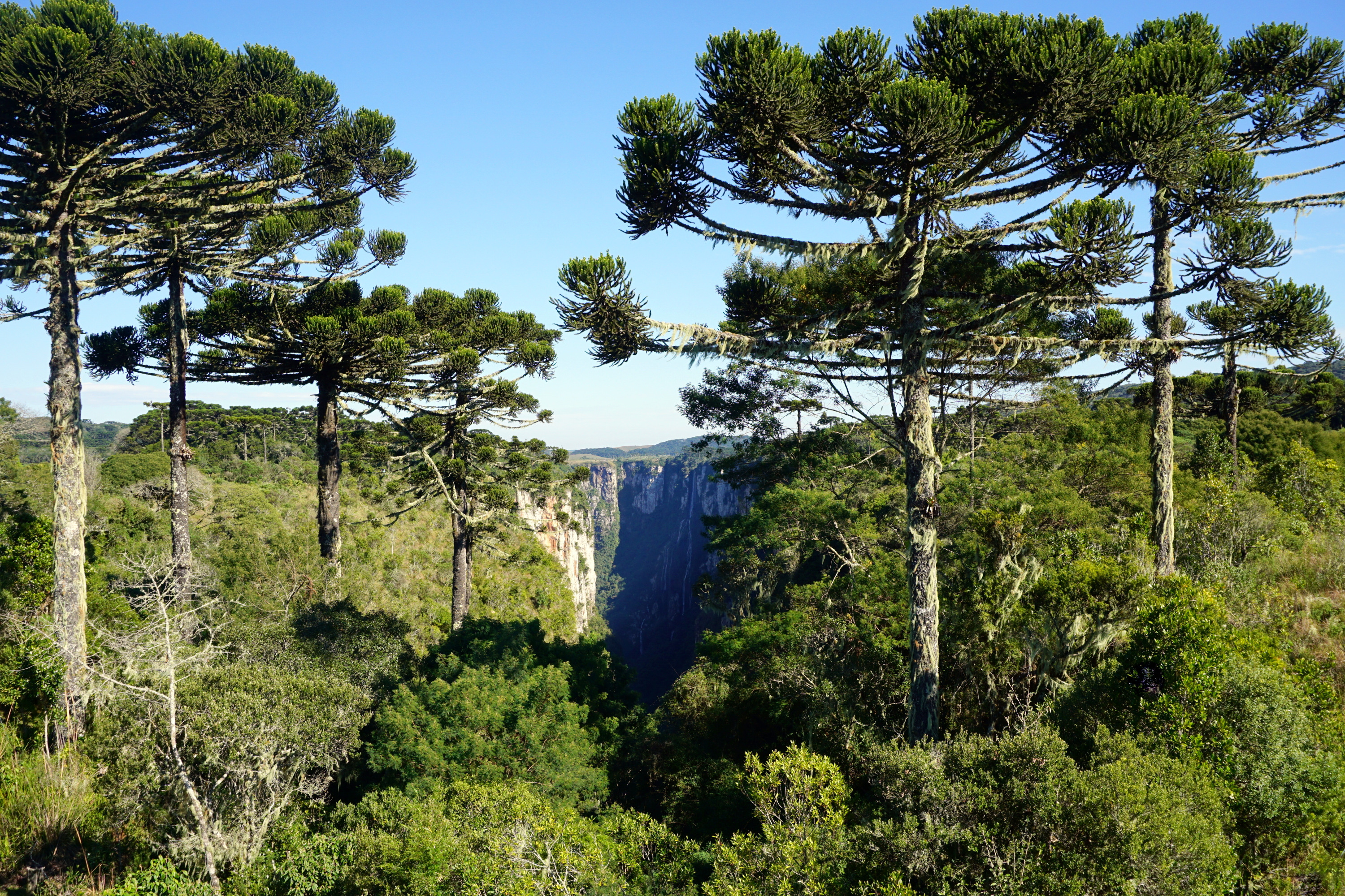
(Portuguese) English: The Itaimbezinho is a canyon in the state of Rio Grande do Sul, Brazil, about 170 km from Porto Alegre, near the border of the state of Santa Catarina. It is part of the Aparados da Serra National Park. Deutsch: Itaimbezinho ist ein natürlicher Felscanyon im Norden des brasilianischen Bundesstaates Rio Grande do Sul ca. 170 km nordöstlich von Porto Alegre.
Der Itaimbezinho hat eine Länge von 5,8 km eine Breite an der breitesten Stelle von 2 km und eine Höhe von ca. 700 Metern. Er gehört zum Nationalpark Aparados da Serra, welcher in den Bundesstaat Santa Catarina hinüberreicht. Français : Le canyon d'Itaimbezinho (Cânion do Itaimbezinho en portugais) est un canyon du massif de la Serra Geral. Il se situe à la limite des États du Rio Grande do Sul et de Santa Catarina, au Brésil. Il s'agit de la principale curiosité naturelle du parc national d'Aparados da Serra.
Le canyon a une longueur d'environ 5 800 m, avec une largeur maximale de 2 000 m et une hauteur maximale d'environ 720 m ; il est traversée par le cours d'eau Perdizes.
|
| ⧼wm-license-information-date⧽ | 2015, {{time}} – invalid date format 04 (help) |
| ⧼wm-license-information-source⧽ | ⧼Wm-license-own-work⧽ |
| ⧼wm-license-information-author⧽ | Germano Roberto Schüür |
ترخيص
|
تاريخ الملف
اضغط على زمن/تاريخ لرؤية الملف كما بدا في هذا الزمن.
| زمن/تاريخ | صورة مصغرة | الأبعاد | مستخدم | تعليق | |
|---|---|---|---|---|---|
| حالي | ★ مراجعة معتمدة 14:34، 22 يناير 2024 | | 3٬000 × 2٬000 (3٫79 ميجابايت) | Pastakhov (نقاش | مساهمات) | Upload https://upload.wikimedia.org/wikipedia/commons/8/84/Itaimbezinho_-_Parque_Nacional_Aparados_da_Serra_33.JPG |
لا يمكنك استبدال هذا الملف.
وصلات
لا يوجد صفحات تصل لهذه الصورة.