ملف:Illinois's 1st congressional district (since 2023) (new version).svg

حجم معاينة PNG لذلك الملف ذي الامتداد SVG: 800 × 534 بكسل. البعد الآخر: 2٬560 × 1٬707 بكسل.
الملف الأصلي (ملف SVG، أبعاده 1٬600 × 1٬067 بكسل، حجم الملف: 1٫59 ميجابايت)
وصف قصير
| ⧼wm-license-information-description⧽ |
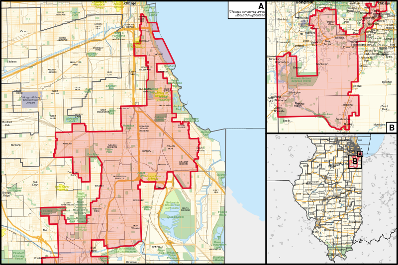
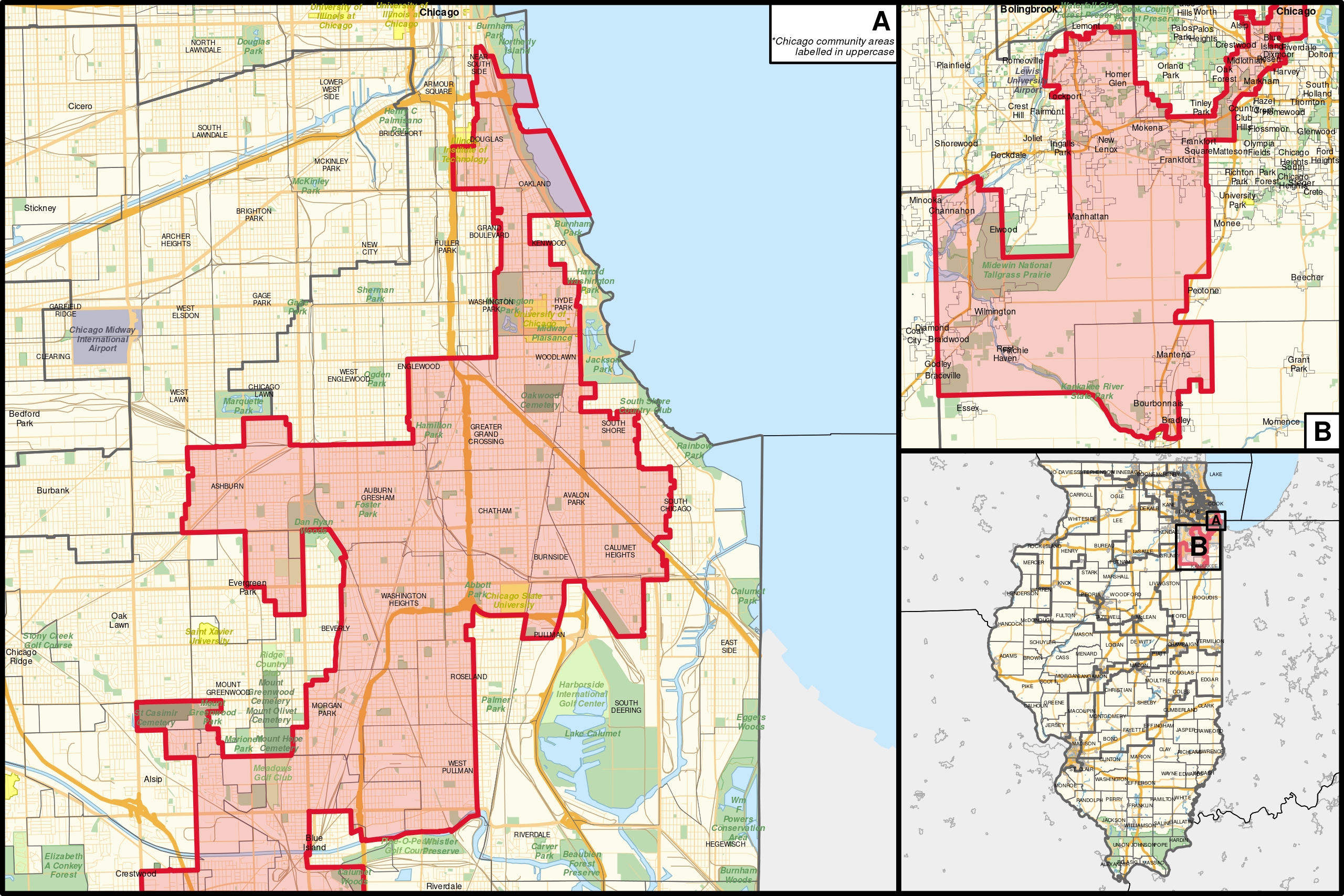
English: The congressional district (since 2023), overlayed with other congressional districts, county boundaries, municipality-equivalent places, and Chicago community areas, as well as motorways, principal arterial roads, publicly-owned lands (including national forests and parks), universities, cemeteries, golf courses, and water areas in Illinois, with neighbouring states coloured in grey. Shapefiles from the United States Census Bureau, the Illinois Department of Transportation, the U.S. Geological Survey (USGS) Gap Analysis Project (GAP), the United States Forest Service, and the National Park Service, converted with Mapshaper (Mercator projection) and Inkscape.
|
| ⧼wm-license-information-date⧽ | 2023 |
| ⧼wm-license-information-source⧽ | ⧼Wm-license-own-work⧽ |
| ⧼wm-license-information-author⧽ | Twotwofourtysix |
ترخيص
|
تاريخ الملف
اضغط على زمن/تاريخ لرؤية الملف كما بدا في هذا الزمن.
| زمن/تاريخ | صورة مصغرة | الأبعاد | مستخدم | تعليق | |
|---|---|---|---|---|---|
| حالي | ★ مراجعة معتمدة 20:47، 9 أكتوبر 2023 | | 1٬600 × 1٬067 (1٫59 ميجابايت) | Pastakhov (نقاش | مساهمات) | Upload https://upload.wikimedia.org/wikipedia/commons/8/86/Illinois%27s_1st_congressional_district_%28since_2023%29_%28new_version%29.svg |
لا يمكنك استبدال هذا الملف.
وصلات
لا يوجد صفحات تصل لهذه الصورة.
_(new_version).svg&oldid=3043770)