ملف:Iberia 237-206BC.svg

حجم معاينة PNG لذلك الملف ذي الامتداد SVG: 727 × 600 بكسل. البعد الآخر: 2٬484 × 2٬048 بكسل.
الملف الأصلي (ملف SVG، أبعاده 924 × 762 بكسل، حجم الملف: 357 كيلوبايت)
وصف قصير
| ⧼wm-license-information-description⧽ |
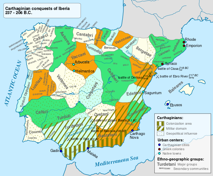
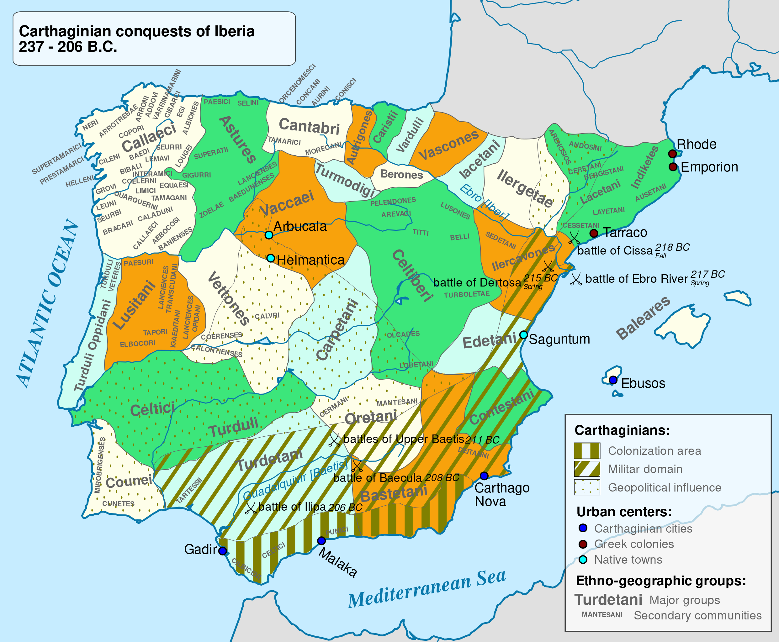
English: Carthaginian conquest in the Iberian Peninsula before and during 2nd Punic War.
|
|||
| ⧼wm-license-information-date⧽ | 2010 | |||
| ⧼wm-license-information-source⧽ | Based on the map done by Portuguese Archeologist Luís Fraga, from the "Campo Arqueológico de Tavira". The reference map can be found at this location [1]. | |||
| ⧼wm-license-information-author⧽ | Alcides Pinto | |||
| ⧼wm-license-information-permission⧽ (⧼wm-license-information-permission-reusing-text⧽) |
|
|||
| ⧼wm-license-information-other-versions⧽ |
|

|
|
This image was created with Inkscape. |
تاريخ الملف
اضغط على زمن/تاريخ لرؤية الملف كما بدا في هذا الزمن.
| زمن/تاريخ | صورة مصغرة | الأبعاد | مستخدم | تعليق | |
|---|---|---|---|---|---|
| حالي | ★ مراجعة معتمدة 00:12، 13 نوفمبر 2023 | | 924 × 762 (357 كيلوبايت) | Pastakhov (نقاش | مساهمات) | Upload https://upload.wikimedia.org/wikipedia/commons/4/49/Iberia_237-206BC.svg |
لا يمكنك استبدال هذا الملف.
وصلات
لا يوجد صفحات تصل لهذه الصورة.