ملف:Heathcote Brook Branch.JPG
لا توجد دقة أعلى متوفرة.
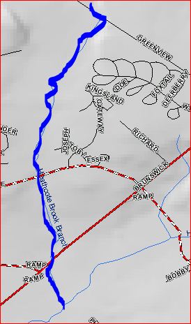
Heathcote_Brook_Branch.JPG (274 × 464 بكسل حجم الملف: 36 كيلوبايت، نوع MIME: image/jpeg)
وصف قصير
| ⧼wm-license-information-description⧽ |
English: Map of Heathcote Brook Branch
|
| ⧼wm-license-information-date⧽ | 2010 |
| ⧼wm-license-information-source⧽ | USGS |
| ⧼wm-license-information-author⧽ | USGS |
| ⧼wm-license-information-permission⧽ (⧼wm-license-information-permission-reusing-text⧽) |
Free USGS Maps |
ترخيص
This image is a work of a United States Geological Survey employee, taken or made during the course of the person's official duties. As a work of the United States Government, the image is in the public domain. For more information, see the USGS copyright policy.
قالب:Original upload log
قالب:Original description page
Upload date | User | Bytes | Dimensions | Comment
- 2010-07-19 22:20 (UTC) | Chemicalinterest | 37311 (bytes) | 274×464 | {{Information |Description = Map of [[Heathcote Brook Branch]] |Source = USGS |Date = ~~~~~ |Author = USGS and ~~~ |Permission = Free USGS Maps |other_versions = none }}
تاريخ الملف
اضغط على زمن/تاريخ لرؤية الملف كما بدا في هذا الزمن.
| زمن/تاريخ | صورة مصغرة | الأبعاد | مستخدم | تعليق | |
|---|---|---|---|---|---|
| حالي | ★ مراجعة معتمدة 13:47، 7 أكتوبر 2023 | | 274 × 464 (36 كيلوبايت) | Pastakhov (نقاش | مساهمات) | Upload https://upload.wikimedia.org/wikipedia/commons/9/9a/Heathcote_Brook_Branch.JPG |
لا يمكنك استبدال هذا الملف.
وصلات
لا يوجد صفحات تصل لهذه الصورة.