ملف:Gokaido Edo Five Routes Map.png
حجم هذه المعاينة: 725 × 600 بكسل. البعد الآخر: 1٬566 × 1٬295 بكسل.
الملف الأصلي (1٬566 × 1٬295 بكسل حجم الملف: 807 كيلوبايت، نوع MIME: image/png)
وصف قصير
| ⧼wm-license-information-description⧽ |
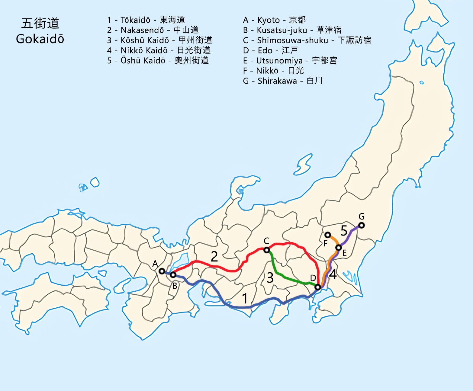
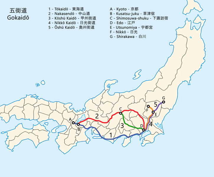
English: A map of the Gokaidō (五街道, Five Routes). These were the five centrally administered routes (kaidō) that connected Edo (now Tokyo) with the outer provinces during the Edo period (1603–1868).
(Japanese) |
| ⧼wm-license-information-date⧽ | 2022 |
| ⧼wm-license-information-source⧽ | ⧼Wm-license-own-work⧽ |
| ⧼wm-license-information-author⧽ | Artanisen |
ترخيص
|
تاريخ الملف
اضغط على زمن/تاريخ لرؤية الملف كما بدا في هذا الزمن.
| زمن/تاريخ | صورة مصغرة | الأبعاد | مستخدم | تعليق | |
|---|---|---|---|---|---|
| حالي | ★ مراجعة معتمدة 19:19، 8 نوفمبر 2023 | | 1٬566 × 1٬295 (807 كيلوبايت) | Pastakhov (نقاش | مساهمات) | Upload https://upload.wikimedia.org/wikipedia/commons/6/6c/Gokaido_Edo_Five_Routes_Map.png |
لا يمكنك استبدال هذا الملف.
وصلات
لا يوجد صفحات تصل لهذه الصورة.