ملف:Gila County Incorporated and Unincorporated areas Claypool highlighted.svg

حجم معاينة PNG لذلك الملف ذي الامتداد SVG: 564 × 599 بكسل. البعد الآخر: 1٬927 × 2٬048 بكسل.
الملف الأصلي (ملف SVG، أبعاده 800 × 850 بكسل، حجم الملف: 96 كيلوبايت)
وصف قصير
قالب:Igen
| ⧼wm-license-information-description⧽ |
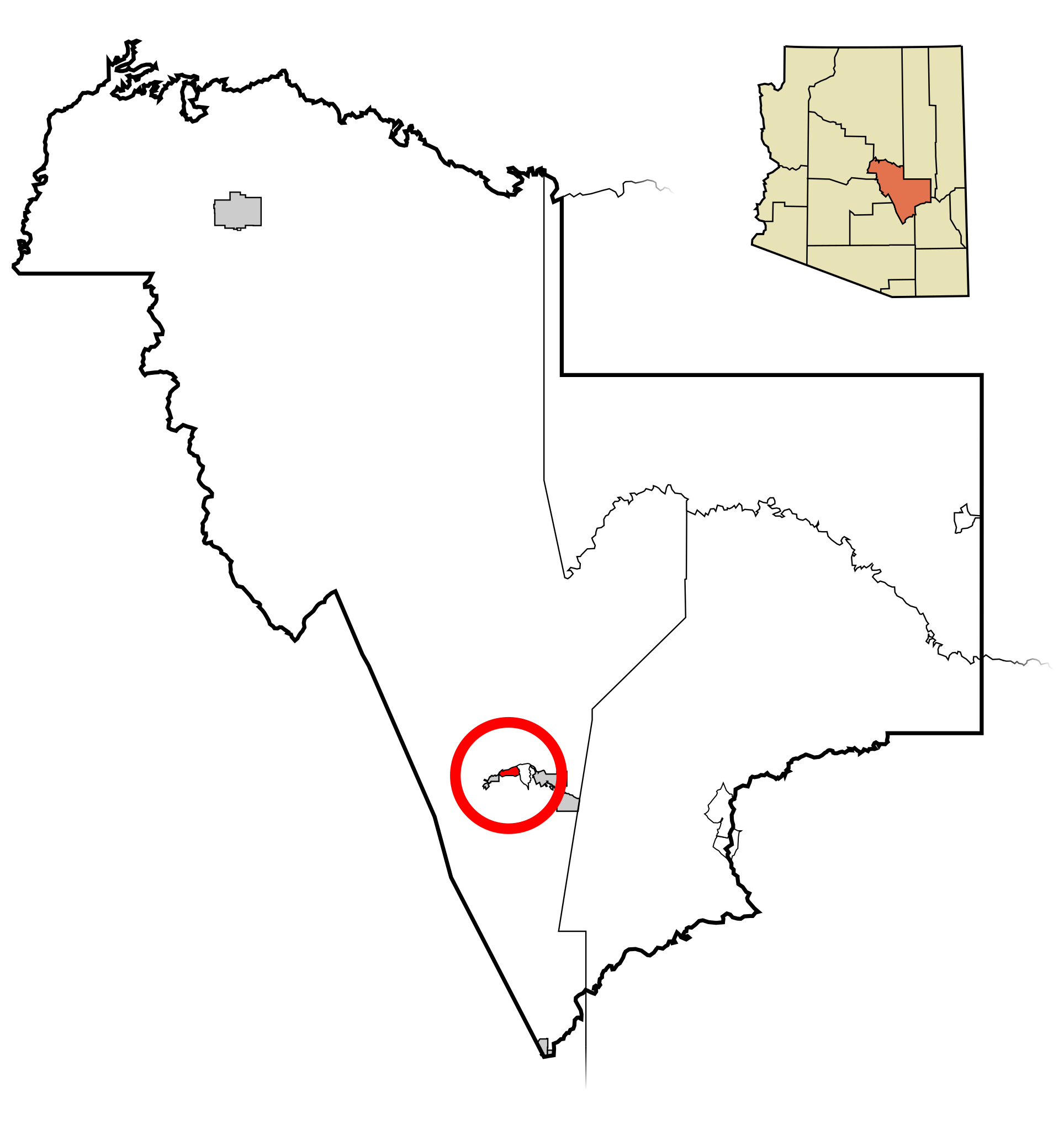
This map shows the incorporated areas and unincorporated areas in Gila County, Arizona. Claypool is highlighted in red. Incorporated cities are shown in gray and unincorporated communities or CDPs are shown in white. Data for the borders and locations are based on maps from the US Census Bureau TIGER Map Server. I created this map in Inkscape. |
| ⧼wm-license-information-date⧽ | 2007 |
| ⧼wm-license-information-source⧽ | My own work, based on public domain information |
| ⧼wm-license-information-author⧽ | Ixnayonthetimmay |
ترخيص
تاريخ الملف
اضغط على زمن/تاريخ لرؤية الملف كما بدا في هذا الزمن.
| زمن/تاريخ | صورة مصغرة | الأبعاد | مستخدم | تعليق | |
|---|---|---|---|---|---|
| حالي | ★ مراجعة معتمدة 19:27، 2 نوفمبر 2023 | | 800 × 850 (96 كيلوبايت) | Pastakhov (نقاش | مساهمات) | Upload https://upload.wikimedia.org/wikipedia/commons/4/40/Gila_County_Incorporated_and_Unincorporated_areas_Claypool_highlighted.svg |
لا يمكنك استبدال هذا الملف.
وصلات
لا يوجد صفحات تصل لهذه الصورة.