ملف:Gerona,Tarlacjf4924 04.JPG

حجم هذه المعاينة: 800 × 600 بكسل. البعدان الآخران: 2٬560 × 1٬920 بكسل | 4٬608 × 3٬456 بكسل.
الملف الأصلي (4٬608 × 3٬456 بكسل حجم الملف: 6٫1 ميجابايت، نوع MIME: image/jpeg)
وصف قصير
| ⧼wm-license-information-description⧽ |
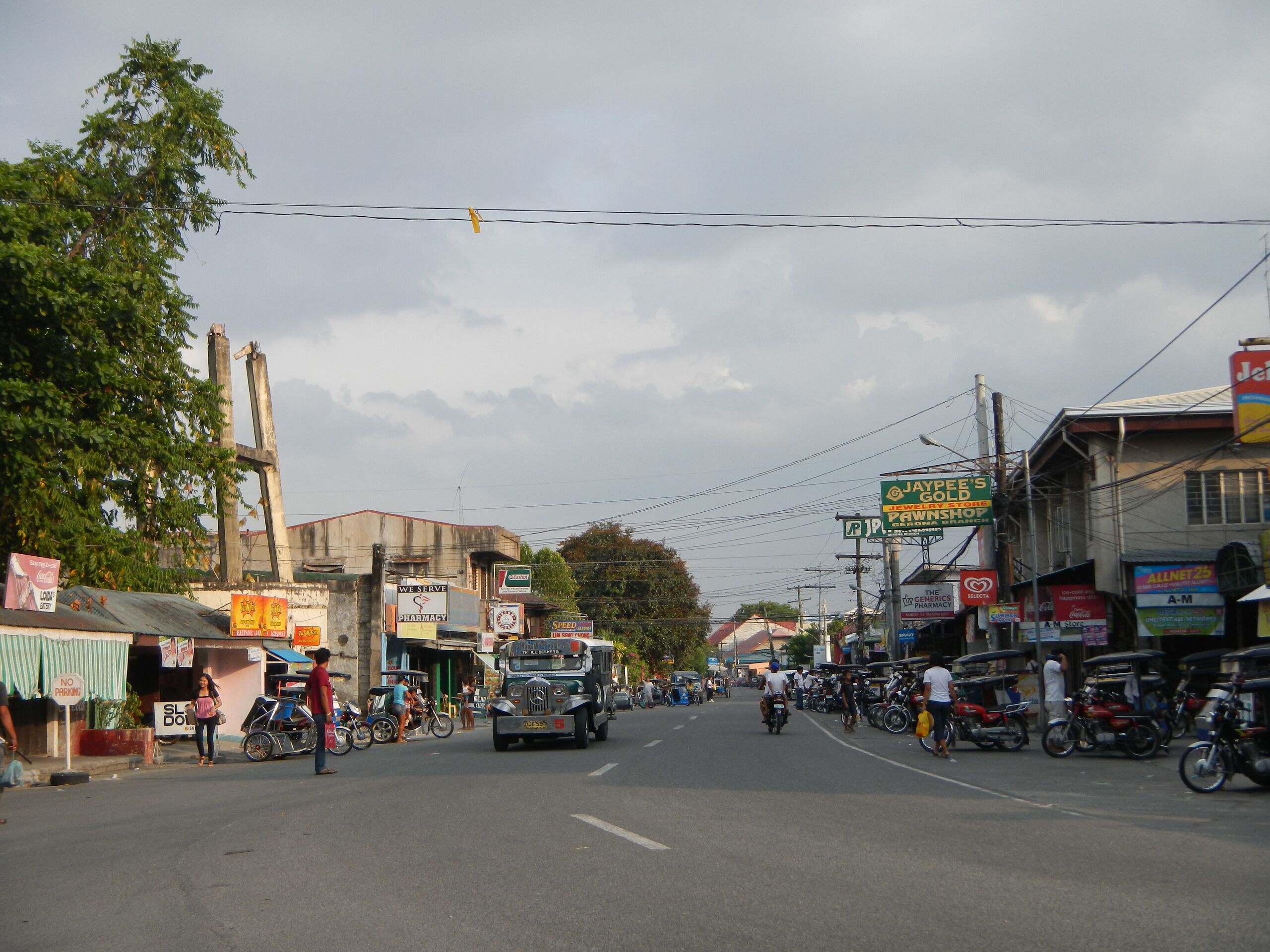
English: Gerona, Tarlac[1]Gerona is a first-class municipality in the province of Tarlac, Philippines. According to the 2010 census, it has a population of 83,084 people. The MacArthur Highway goes through the center of the town. Gerona has a land area of 12,889 hectares (31,850 acres) of plain and rugged agricultural land representing 4.63% of the province total area. The Tarlac River, which originates from the eastern slopes of the Zambales Mountain, cuts across the west central areas, dividing the town into two parts.[2]Area: 128.89 km² ZIP Code: 2302[3]The history of the Municipality of Gerona can be traced back during the reign of the Spaniards, when the Dominican Missionaries in the Philippines started to propagate the Catholic faith in the whole archipelago in 1704.[4]This place is situated in Tarlac, Region 3, Philippines, its geographical coordinates are 15° 36' 23" North, 120° 36' 0" East and its original name (with diacritics) is Gerona. original name: Gerona - geographical location: Tarlac, Region 3, Philippines, Asia geographical coordinates: 15° 36' 23" North, 120° 36' 0" East[5]Isdaan Floating Restaurant
|
| ⧼wm-license-information-date⧽ | 2013, {{time}} – invalid date format 48 (help) |
| ⧼wm-license-information-source⧽ | ⧼Wm-license-own-work⧽ |
| ⧼wm-license-information-author⧽ | Ramon FVelasquez |
ترخيص
|
تاريخ الملف
اضغط على زمن/تاريخ لرؤية الملف كما بدا في هذا الزمن.
| زمن/تاريخ | صورة مصغرة | الأبعاد | مستخدم | تعليق | |
|---|---|---|---|---|---|
| حالي | ★ مراجعة معتمدة 14:45، 14 أكتوبر 2023 | | 4٬608 × 3٬456 (6٫1 ميجابايت) | Pastakhov (نقاش | مساهمات) | Upload https://upload.wikimedia.org/wikipedia/commons/8/85/Gerona%2CTarlacjf4924_04.JPG |
لا يمكنك استبدال هذا الملف.
وصلات
لا يوجد صفحات تصل لهذه الصورة.