ملف:Geodetic Observatory Wettzell.jpg

حجم هذه المعاينة: 800 × 554 بكسل. البعد الآخر: 1٬024 × 709 بكسل.
الملف الأصلي (1٬024 × 709 بكسل حجم الملف: 324 كيلوبايت، نوع MIME: image/jpeg)
وصف قصير
| ⧼wm-license-information-description⧽ |
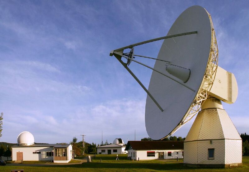
English: Geodetic Observatory and fundamental station Wettzell, Bavaria, Germany. The two domes at left an in the center house the Satellie Observing System Wettzell (SOS-W) and the Wettzell Laser Ranging System (WLRS), respectively. At right, the 20m disch of the Radiotelescope Wettzell (RTW) can be seen.
Deutsch: Geodätisches Observatorium und Fundamentalstation Wettzell, Bayern. Die beiden Kuppeln links und in der Mitte beherbergen das Satellie Observing System Wettzell (SOS-W) und das Wettzell Laser Ranging System (WLRS). Rechts im Bild ist die 20m-Schüssel des Radioteleskops Wettzell (RTW) zu sehen.
|
| ⧼wm-license-information-date⧽ | 2008 |
| ⧼wm-license-information-source⧽ | ⧼Wm-license-own-work⧽ |
| ⧼wm-license-information-author⧽ | H. Raab (User:Vesta) |
| ⧼wm-license-information-other-versions⧽ |
49°8′42.9″N 12°52′38.9″E / 49.145250°N 12.877472°E
ترخيص
|

تاريخ الملف
اضغط على زمن/تاريخ لرؤية الملف كما بدا في هذا الزمن.
| زمن/تاريخ | صورة مصغرة | الأبعاد | مستخدم | تعليق | |
|---|---|---|---|---|---|
| حالي | ★ مراجعة معتمدة 14:14، 18 أكتوبر 2023 | | 1٬024 × 709 (324 كيلوبايت) | Pastakhov (نقاش | مساهمات) | Upload https://upload.wikimedia.org/wikipedia/commons/4/4b/Geodetic_Observatory_Wettzell.jpg |
لا يمكنك استبدال هذا الملف.
وصلات
لا يوجد صفحات تصل لهذه الصورة.