ملف:French Algeria 1934-1955 administrative map-es.svg

حجم معاينة PNG لذلك الملف ذي الامتداد SVG: 604 × 600 بكسل. البعد الآخر: 2٬062 × 2٬048 بكسل.
الملف الأصلي (ملف SVG، أبعاده 1٬287 × 1٬278 بكسل، حجم الملف: 1٫53 ميجابايت)
وصف قصير
| ⧼wm-license-information-description⧽ |
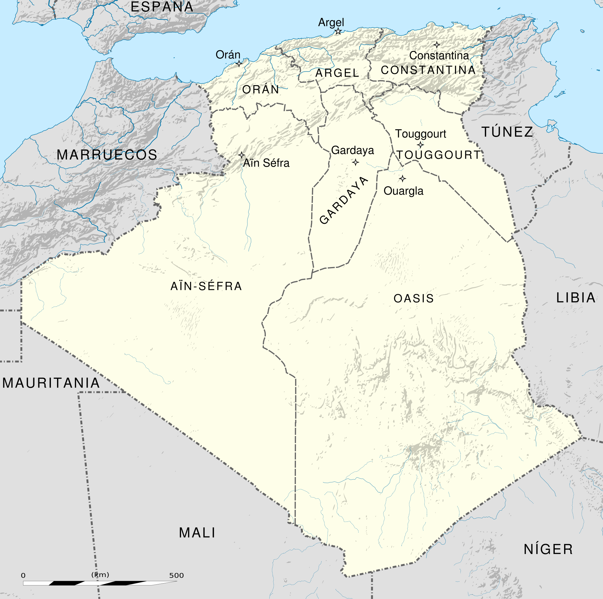
English: Administrative map of French Algeria from 1905 to 1955. Three departments in the north: Alger, Constantine, Oran. Four territories in the south: Aïn-Sefra, Ghardaïa, Oasis (capital Ouargla) and Touggourt. The international boundaries shown are from 1934 to 1962
|
| ⧼wm-license-information-date⧽ | 2017 |
| ⧼wm-license-information-source⧽ | قالب:F |
| ⧼wm-license-information-author⧽ |
ترخيص
تاريخ الملف
اضغط على زمن/تاريخ لرؤية الملف كما بدا في هذا الزمن.
| زمن/تاريخ | صورة مصغرة | الأبعاد | مستخدم | تعليق | |
|---|---|---|---|---|---|
| حالي | ★ مراجعة معتمدة 22:43، 10 أكتوبر 2023 | | 1٬287 × 1٬278 (1٫53 ميجابايت) | Pastakhov (نقاش | مساهمات) | Upload https://upload.wikimedia.org/wikipedia/commons/2/26/French_Algeria_1934-1955_administrative_map-es.svg |
لا يمكنك استبدال هذا الملف.
وصلات
لا يوجد صفحات تصل لهذه الصورة.