ملف:Fürstentum Hohenlohe Karte.png

حجم هذه المعاينة: 716 × 600 بكسل. البعدان الآخران: 2٬445 × 2٬048 بكسل | 9٬319 × 7٬805 بكسل.
الملف الأصلي (9٬319 × 7٬805 بكسل حجم الملف: 189٫14 ميجابايت، نوع MIME: image/png)
وصف قصير
| ⧼wm-license-information-description⧽ |
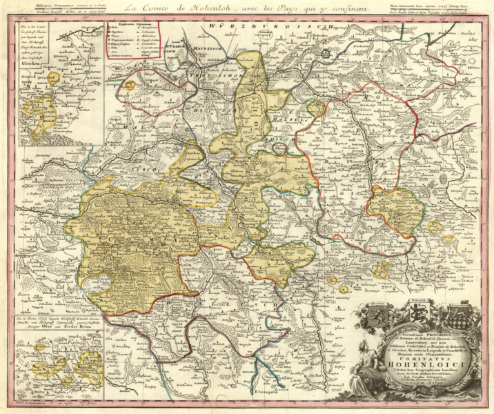
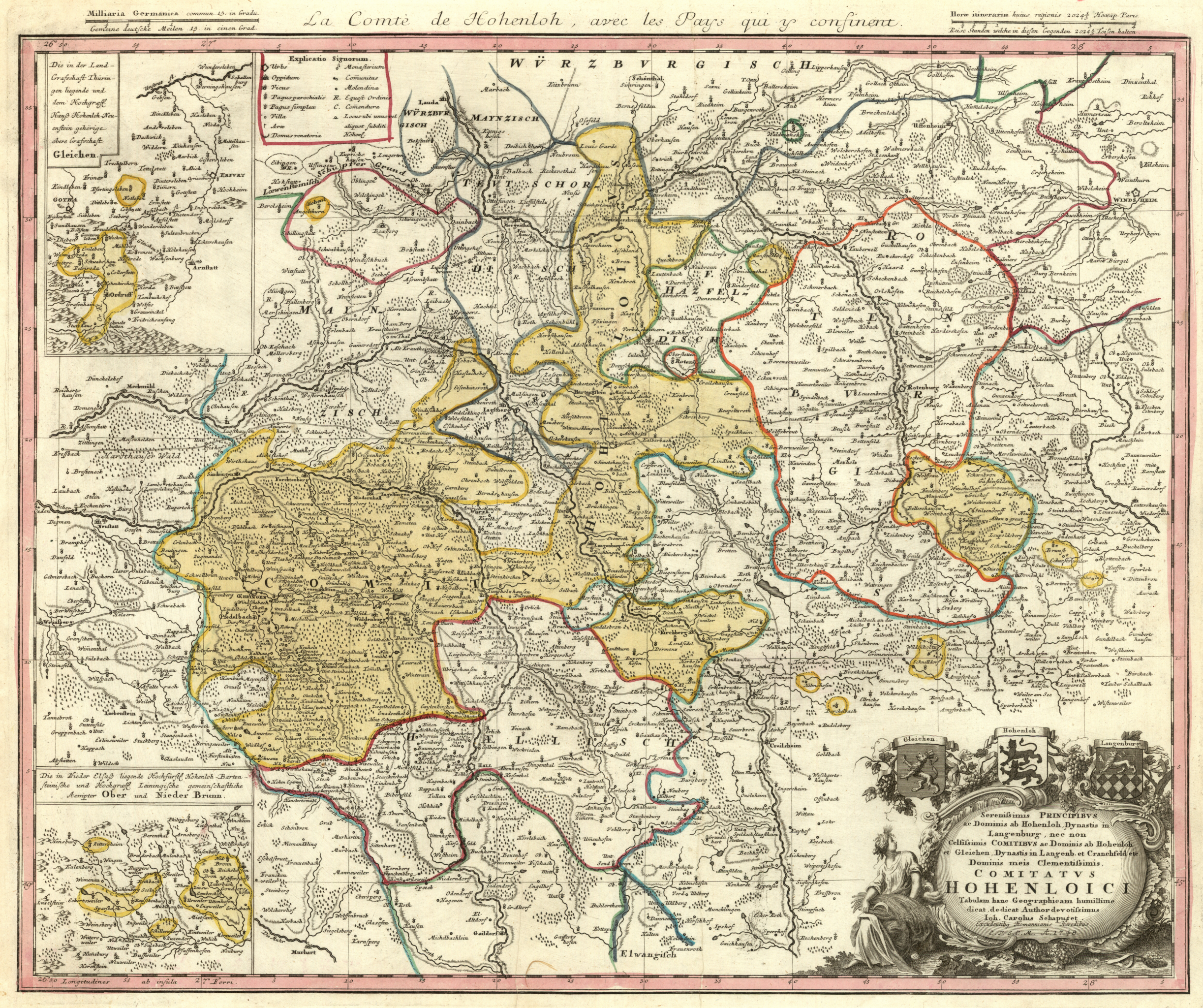
Deutsch: Karte des Fürstentums Hohenlohe, kolorierter Kupferstich.
English: Map of the Principality of Hohenlohe, colorized copper engraving.
|
| ⧼wm-license-information-date⧽ | 1748 |
| ⧼wm-license-information-source⧽ | Homann Erben, Nürnberg 1748. (Kartensammlung Moll) |
| ⧼wm-license-information-author⧽ | Johann Karl Chapuset (1694–1770). Printed by Homann Heirs, 1748. |
| ⧼wm-license-information-other-versions⧽ |
|
Sereniſsimis Principibvs ac Dominis ab Hohenloh, Dynastis in Langenburg nec non Celſiſsimis Comitibvs ac Dominis ab Hohenloh et Gleichen, Dynastis in Langenb. et Cranchfeld etc. Dominis meis Clementiſsimis, Comitatvs Hohenloici Tabulam hanc Geographicam humillime dicat dedicat Author devotiſsimus Ioh. Carolus Schapuzet. Excudentibus Homannianis Heredibus C.P.S.C.M. A. 1748.
ترخيص
|
|
This file is in the ملكية عامة because its copyright has expired in the United States and those countries with a copyright term of no more than the life of the author plus 100 years.
|
تاريخ الملف
اضغط على زمن/تاريخ لرؤية الملف كما بدا في هذا الزمن.
| زمن/تاريخ | صورة مصغرة | الأبعاد | مستخدم | تعليق | |
|---|---|---|---|---|---|
| حالي | ★ مراجعة معتمدة 22:41، 4 نوفمبر 2023 | | 9٬319 × 7٬805 (189٫14 ميجابايت) | Pastakhov (نقاش | مساهمات) | Upload https://upload.wikimedia.org/wikipedia/commons/0/00/F%C3%BCrstentum_Hohenlohe_Karte.png |
لا يمكنك استبدال هذا الملف.
وصلات
لا يوجد صفحات تصل لهذه الصورة.