ملف:Durgan - geograph.org.uk - 1170039.jpg
لا توجد دقة أعلى متوفرة.
Durgan_-_geograph.org.uk_-_1170039.jpg (640 × 415 بكسل حجم الملف: 121 كيلوبايت، نوع MIME: image/jpeg)
وصف قصير
| ⧼wm-license-information-description⧽ |
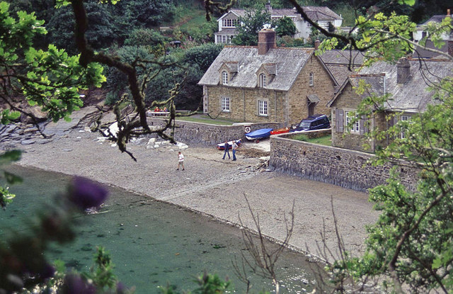
English: Durgan Looking down on this tiny fishing hamlet from the narrow lane that approaches it from Mawnan Smith. The hamlet is now entirely in the hands of the National Trust.
|
| ⧼wm-license-information-date⧽ | 2003 |
| ⧼wm-license-information-source⧽ | From geograph.org.uk |
| ⧼wm-license-information-author⧽ | Stephen McKay |
| ⧼wm-license-cc-attribution⧽ (قالب:I18n/Credit line) |
Stephen McKay / Durgan / |
50°06′13″N 5°06′52″W / 50.10348°N 5.1144°W قالب:Object location
_heading:315)
ترخيص
تاريخ الملف
اضغط على زمن/تاريخ لرؤية الملف كما بدا في هذا الزمن.
| زمن/تاريخ | صورة مصغرة | الأبعاد | مستخدم | تعليق | |
|---|---|---|---|---|---|
| حالي | ★ مراجعة معتمدة 03:16، 21 أكتوبر 2023 | | 640 × 415 (121 كيلوبايت) | Pastakhov (نقاش | مساهمات) | Upload https://upload.wikimedia.org/wikipedia/commons/a/a3/Durgan_-_geograph.org.uk_-_1170039.jpg |
لا يمكنك استبدال هذا الملف.
وصلات
لا يوجد صفحات تصل لهذه الصورة.