ملف:Disused Butts - geograph.org.uk - 614482.jpg
لا توجد دقة أعلى متوفرة.
Disused_Butts_-_geograph.org.uk_-_614482.jpg (640 × 480 بكسل حجم الملف: 80 كيلوبايت، نوع MIME: image/jpeg)
وصف قصير
| ⧼wm-license-information-description⧽ |
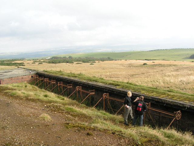
English: Disused Butts The range here ceased to operate in 1950's, after the closure of Churchill Barracks in Ayr. The range building at the LHS of the picture is marked on the OS map.
|
| ⧼wm-license-information-date⧽ | 2007 |
| ⧼wm-license-information-source⧽ | From geograph.org.uk |
| ⧼wm-license-information-author⧽ | Karen Vernon |
| ⧼wm-license-cc-attribution⧽ (قالب:I18n/Credit line) |
Karen Vernon / Disused Butts / |
55°22′47″N 4°43′26″W / 55.37972°N 4.7238°W قالب:Object location
_heading:90)
ترخيص
تاريخ الملف
اضغط على زمن/تاريخ لرؤية الملف كما بدا في هذا الزمن.
| زمن/تاريخ | صورة مصغرة | الأبعاد | مستخدم | تعليق | |
|---|---|---|---|---|---|
| حالي | ★ مراجعة معتمدة 16:12، 6 نوفمبر 2023 | | 640 × 480 (80 كيلوبايت) | Pastakhov (نقاش | مساهمات) | Upload https://upload.wikimedia.org/wikipedia/commons/6/69/Disused_Butts_-_geograph.org.uk_-_614482.jpg |
لا يمكنك استبدال هذا الملف.
وصلات
لا يوجد صفحات تصل لهذه الصورة.