ملف:DEMChartreuse.png
حجم هذه المعاينة: 664 × 599 بكسل. البعد الآخر: 2٬042 × 1٬843 بكسل.
الملف الأصلي (2٬042 × 1٬843 بكسل حجم الملف: 1٫08 ميجابايت، نوع MIME: image/png)
وصف قصير
| ⧼wm-license-information-description⧽ |
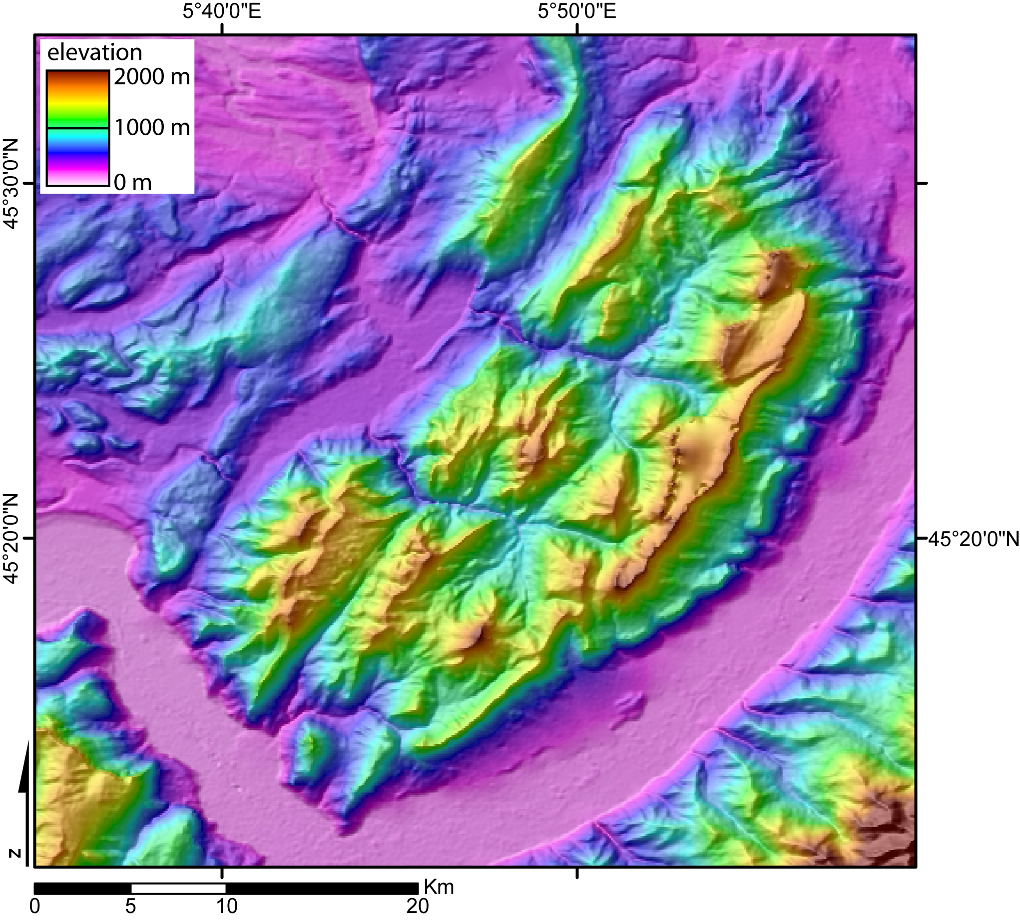
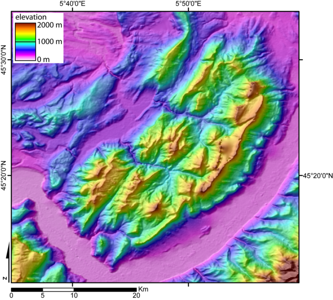
Digital Elevation Model of the Chartreuse massif (French Alps) created by jide from the 90m pixel size SRTM dataset. The broad valley to the SW and SE is the Isere valley ("Gresivaudan").The mountains to the SE is the Belledonne massif, and to the SW the Vercors massif. The city of Grenoble lies in the Gresivaudan, at the very south of the Chartreuse massif. |
| ⧼wm-license-information-date⧽ | قالب:Original upload date |
| ⧼wm-license-information-source⧽ | No machine-readable source provided. Own work assumed (based on copyright claims). |
| ⧼wm-license-information-author⧽ | No machine-readable author provided. Jide~commonswiki assumed (based on copyright claims). |
ترخيص
|

derivative works
تاريخ الملف
اضغط على زمن/تاريخ لرؤية الملف كما بدا في هذا الزمن.
| زمن/تاريخ | صورة مصغرة | الأبعاد | مستخدم | تعليق | |
|---|---|---|---|---|---|
| حالي | ★ مراجعة معتمدة 06:23، 21 أكتوبر 2023 | | 2٬042 × 1٬843 (1٫08 ميجابايت) | Pastakhov (نقاش | مساهمات) | Upload https://upload.wikimedia.org/wikipedia/commons/5/5a/DEMChartreuse.png |
لا يمكنك استبدال هذا الملف.
وصلات
لا يوجد صفحات تصل لهذه الصورة.